Wederom vond ik een zeer aardig 'leesstuk' op netweather.
Some highly rarified synoptics being prgrammed right now with a retrogressing high latitude block and polar trough dropping into Scandinavia with the jet stream highly depressed and large puddle of cold air ensconsed over much of NW Europe. The models may well struggle with the detail here, both long and short term. A good time then to step back with some considered analysis.
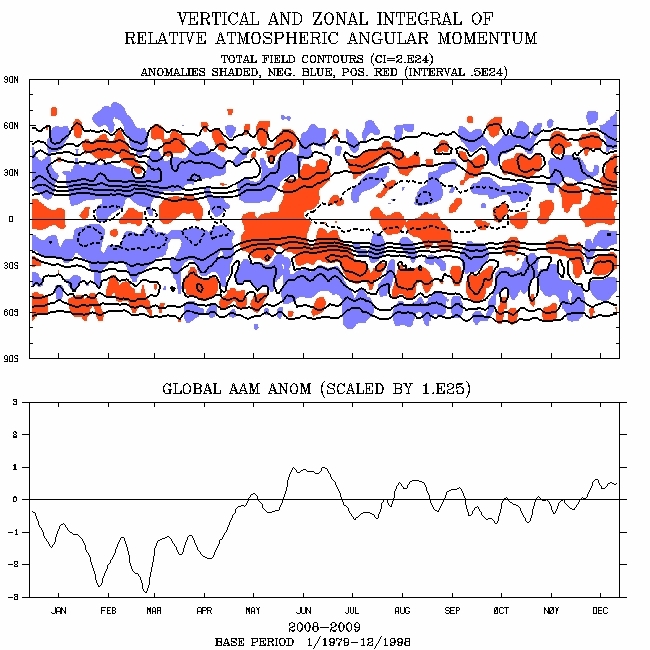
Overall global angular momentum is slightly above average. Most importantly, positive (west) wind anomalies which developed over the Equator mid November onwards have been fluxed poleward over the last three weeks c/o zonal mean transports. Note the upward spike in angular momentum. This is setting the scene for a cold pattern to return into January. More on that later.
afbeelding 1
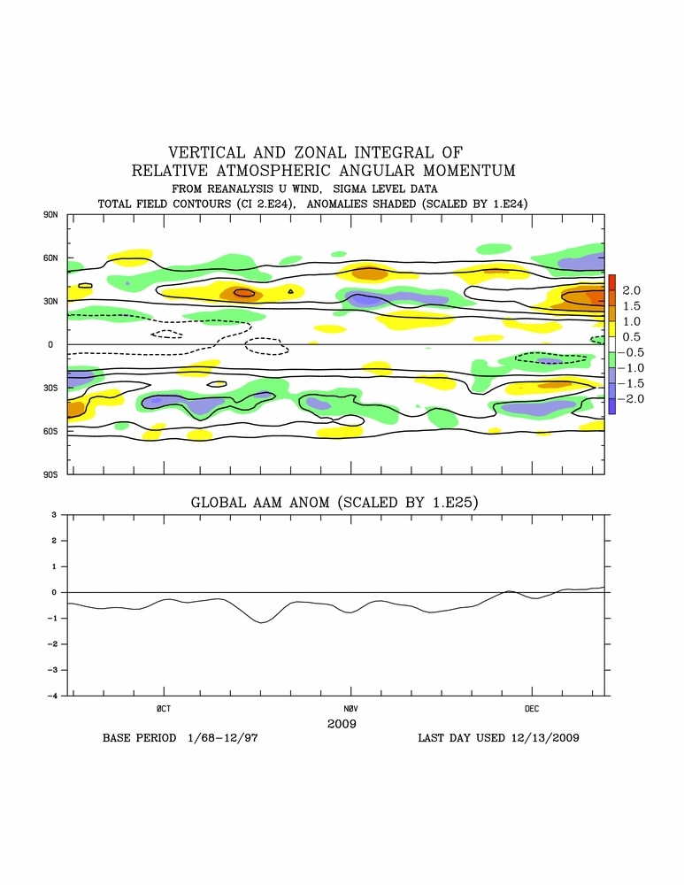
Relative angular momentum is now shaping upward thanks to fluxing of westerlies from the tropics into the sub-tropics across 30N. This can be seen as a positive (west) angular momentum anomaly on the plots. These west winds continue across the Pacific and will prop up realtive and total angular momentum, ensuring that we will continue to orbit around phase 4 of the Global Wind Oscillation.
afbeelding 2
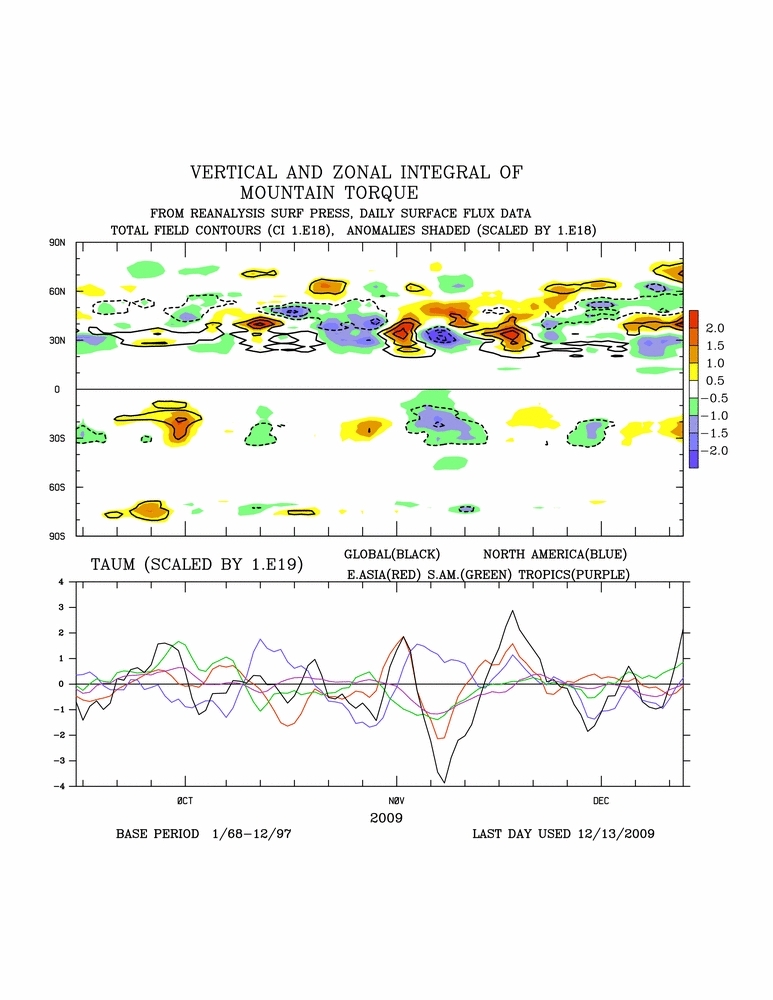
Latest updates identify a developing positive mountain torque which is driving tendency in relative angular momentum and the GWO well into phase 4:
afbeelding 3
afbeelding 4
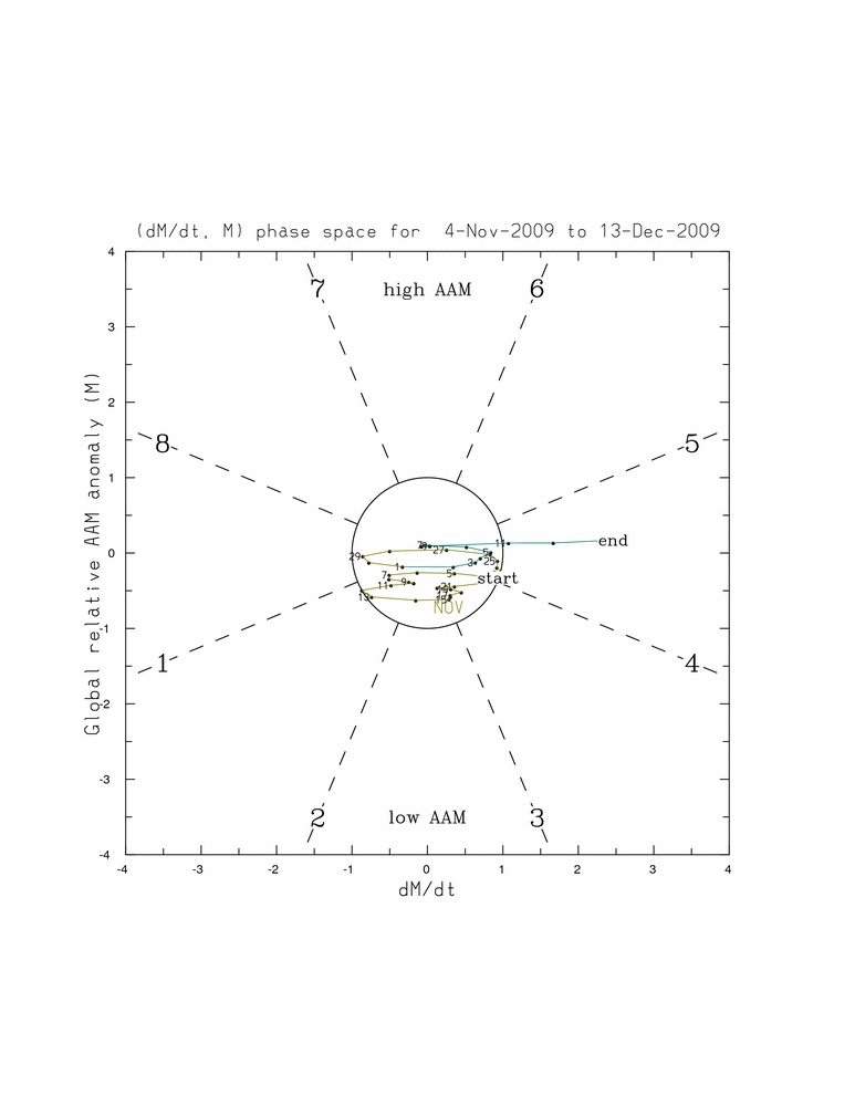
What this means is that we will more than likely close out the month with the GWO in phase 4. Composites suggest that the upper flow will tend to be flat and extend into Europe. With the cold pool established, any erosion from the south is likely to be attritional and not likely to displace the cold pool totally, more so from the north of the UK.
afbeelding 5
Some northward extension of the Atlantic airmass is however likely, purely as a downstream result of the Atlantic trough. Where this comes into contact with the cold Arctic airmass, there will be a battleground scenario develop. Christmas or just before looks really interesting from this point of view, perhaps temperatures recovering to average in the south of the UK between Christmas and New Year, the more average conditions pushing slightly further north around New Year.
Moving forward, we are starting to see a convective signal come into the Indian Ocean where SSTAs are supportive of deep convection. This, allied to convection in the western Pacific, will generate further mean zonal west wind anomalies which will propagate across the tropics into the sub-tropics. With the west wind additions generated in November still in the system, total and relative angular momentum will increase sending the GWO into a phase 5 orbit. Torques will vary this orbit backwards and forwards around phases 5-6-7 in January.
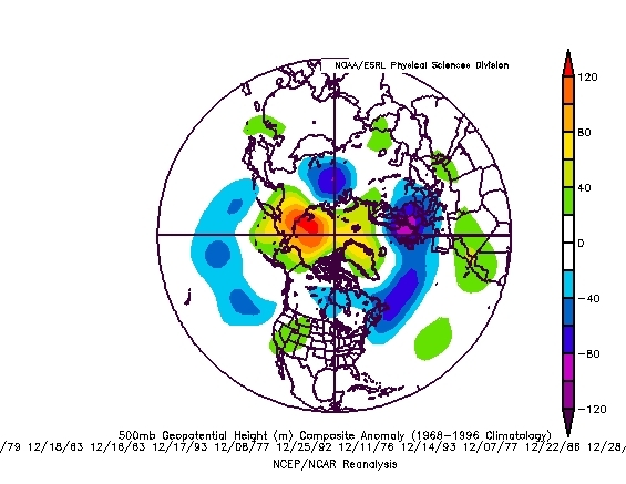
Composites for these phases suggest a strong -NAO signal with positive height anomalies across the North Atlantic from Newfoundland to Iceland.
Some highly rarified synoptics being prgrammed right now with a retrogressing high latitude block and polar trough dropping into Scandinavia with the jet stream highly depressed and large puddle of cold air ensconsed over much of NW Europe. The models may well struggle with the detail here, both long and short term. A good time then to step back with some considered analysis.
Overall global angular momentum is slightly above average. Most importantly, positive (west) wind anomalies which developed over the Equator mid November onwards have been fluxed poleward over the last three weeks c/o zonal mean transports. Note the upward spike in angular momentum. This is setting the scene for a cold pattern to return into January. More on that later.
afbeelding 1
Relative angular momentum is now shaping upward thanks to fluxing of westerlies from the tropics into the sub-tropics across 30N. This can be seen as a positive (west) angular momentum anomaly on the plots. These west winds continue across the Pacific and will prop up realtive and total angular momentum, ensuring that we will continue to orbit around phase 4 of the Global Wind Oscillation.
afbeelding 2
Latest updates identify a developing positive mountain torque which is driving tendency in relative angular momentum and the GWO well into phase 4:
afbeelding 3
afbeelding 4
What this means is that we will more than likely close out the month with the GWO in phase 4. Composites suggest that the upper flow will tend to be flat and extend into Europe. With the cold pool established, any erosion from the south is likely to be attritional and not likely to displace the cold pool totally, more so from the north of the UK.
afbeelding 5
Some northward extension of the Atlantic airmass is however likely, purely as a downstream result of the Atlantic trough. Where this comes into contact with the cold Arctic airmass, there will be a battleground scenario develop. Christmas or just before looks really interesting from this point of view, perhaps temperatures recovering to average in the south of the UK between Christmas and New Year, the more average conditions pushing slightly further north around New Year.
Moving forward, we are starting to see a convective signal come into the Indian Ocean where SSTAs are supportive of deep convection. This, allied to convection in the western Pacific, will generate further mean zonal west wind anomalies which will propagate across the tropics into the sub-tropics. With the west wind additions generated in November still in the system, total and relative angular momentum will increase sending the GWO into a phase 5 orbit. Torques will vary this orbit backwards and forwards around phases 5-6-7 in January.
Composites for these phases suggest a strong -NAO signal with positive height anomalies across the North Atlantic from Newfoundland to Iceland.
„Et nul ne se connait tant qu'il n'a pas souffert, „C'est une dure loi, mais une loi suprème, „Vieille comme le monde et la fatalité, „Qu'l nous faut du malheur regevoir le baptéme, ~Et qu'a ce triste prix tout doit étre acheté. „Les moissons pour murir out besoin de rosée, „Pour vivre et pour sentir l'homme a besoin de pleura, „La joie a pour symbole une plante brisée, „Humide encore de pluie et couverte de fleurs."