Analyse wijst op ontwikkeling negatieve NAO begin Januari
Bericht van: sebastiaan (bussum) , 22-12-2009 23:24
Gevonden op netweather, komt aardig overeen met waar de oper van EC mee kwam.
Extended long range tools:
GEM 11-15 day mean height anomaly -
http://raleighwx.easternuswx.com/models/cmcensemble/12zCMCENS11-15day500mbHeightAnomalyNH.gif
GFS 11-15 day mean height anomaly -
http://raleighwx.easternuswx.com/models/gfsensemble/12zENS11-15day500mbHeightAnomalyNH.gif
Day 8-10 operational ECM and GFS 12z mean height anomalies -
http://www.meteo.psu.edu/~gadomski/ECMWF_12z/hgtcomp.html
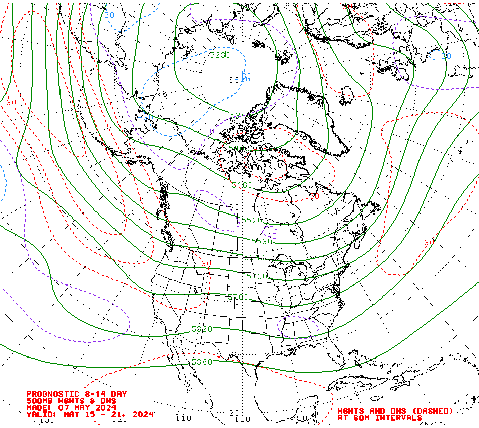
CPC derived 8-14 day mean height anomaly forecast -
http://www.cpc.ncep.noaa.gov/products/predictions/814day/814day.03.gif
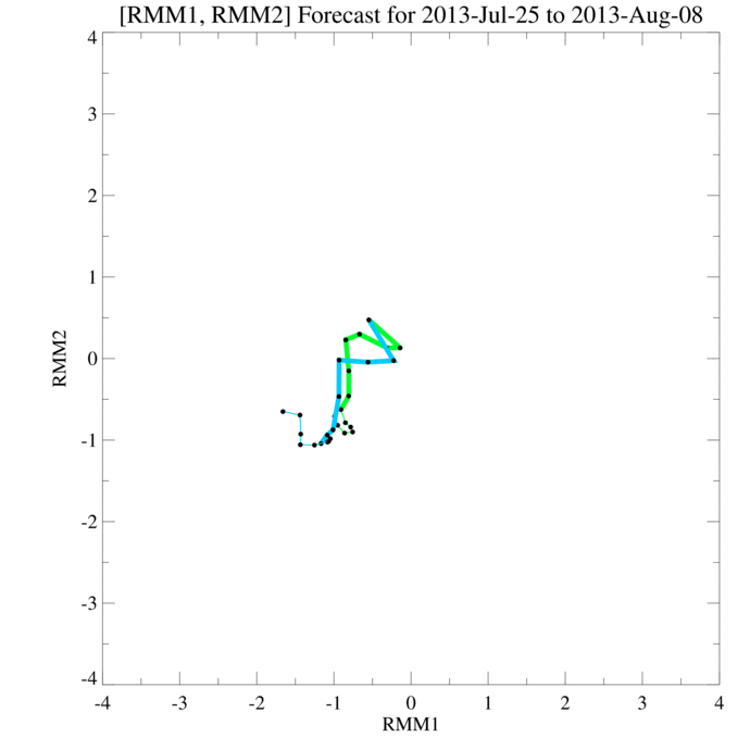
GWO in phase 7, likely to persist in orbits 5-6-7 as we progress into January although falling momentum likely as (1) poleward transport of momentum bringing the northern arm of the jet into play; and (2), tropical convection builds in the Indian Ocean associated with the next MJO wave -
http://www.esrl.noaa.gov/psd/map/images/gcm/gwo_40d.gif
http://www.cpc.ncep.noaa.gov/products/people/wd52qz/mjoindex/index/diagram_40days_forecastGFSOP_CFSOP_GEFS.gif
All of the model guidance and analysis of ocean-atmospheric coupling points solidly towards a -NAO signal developing during early January with a ridge in the Atlantic being thrown up to build heights around southern Greenland and Iceland with low heights over Azores, probably extending into Europe as colder air builds back south from the north and north east.
Extended long range tools:
GEM 11-15 day mean height anomaly -
http://raleighwx.easternuswx.com/models/cmcensemble/12zCMCENS11-15day500mbHeightAnomalyNH.gif
GFS 11-15 day mean height anomaly -
http://raleighwx.easternuswx.com/models/gfsensemble/12zENS11-15day500mbHeightAnomalyNH.gif
Day 8-10 operational ECM and GFS 12z mean height anomalies -
http://www.meteo.psu.edu/~gadomski/ECMWF_12z/hgtcomp.html
CPC derived 8-14 day mean height anomaly forecast -
http://www.cpc.ncep.noaa.gov/products/predictions/814day/814day.03.gif
GWO in phase 7, likely to persist in orbits 5-6-7 as we progress into January although falling momentum likely as (1) poleward transport of momentum bringing the northern arm of the jet into play; and (2), tropical convection builds in the Indian Ocean associated with the next MJO wave -
http://www.esrl.noaa.gov/psd/map/images/gcm/gwo_40d.gif
http://www.cpc.ncep.noaa.gov/products/people/wd52qz/mjoindex/index/diagram_40days_forecastGFSOP_CFSOP_GEFS.gif
All of the model guidance and analysis of ocean-atmospheric coupling points solidly towards a -NAO signal developing during early January with a ridge in the Atlantic being thrown up to build heights around southern Greenland and Iceland with low heights over Azores, probably extending into Europe as colder air builds back south from the north and north east.
Bericht laatst bijgewerkt: 22-12-2009 23:26
„Et nul ne se connait tant qu'il n'a pas souffert, „C'est une dure loi, mais une loi suprème, „Vieille comme le monde et la fatalité, „Qu'l nous faut du malheur regevoir le baptéme, ~Et qu'a ce triste prix tout doit étre acheté. „Les moissons pour murir out besoin de rosée, „Pour vivre et pour sentir l'homme a besoin de pleura, „La joie a pour symbole une plante brisée, „Humide encore de pluie et couverte de fleurs."