De temperatuur van de stratosfeer in de pool gaat de komende tijd flink omhoog.
Ik citeer van netweather
Whether this materialises as a high pressure towards the UK is unknown, as residual energy in the troposphere and the effects of the MJO will have an impact. My feeling is that we will have the potential for a blocked pattern slowly moving eastwards over a period of about 2 weeks. I doubt whether models will handle this too well at this range as it will be against the historic norms which are pre loaded into the forecasts.
+
The jetstream will be shoved well south again come Feb after a temporary buckle last week of Jan due to the magnetic disturbances of the sun. This will see AZH ridge north and get absorbed into GHP/Arctic HP and I thin N to NE'ly winds will dominate first 10days+ of Feb before a migration east of the HP cell to Scandi. It is correct to not need a SSW/MMW that propogates downward to bring cold setup. As has been pointed out we have had sever cold this winter without one.
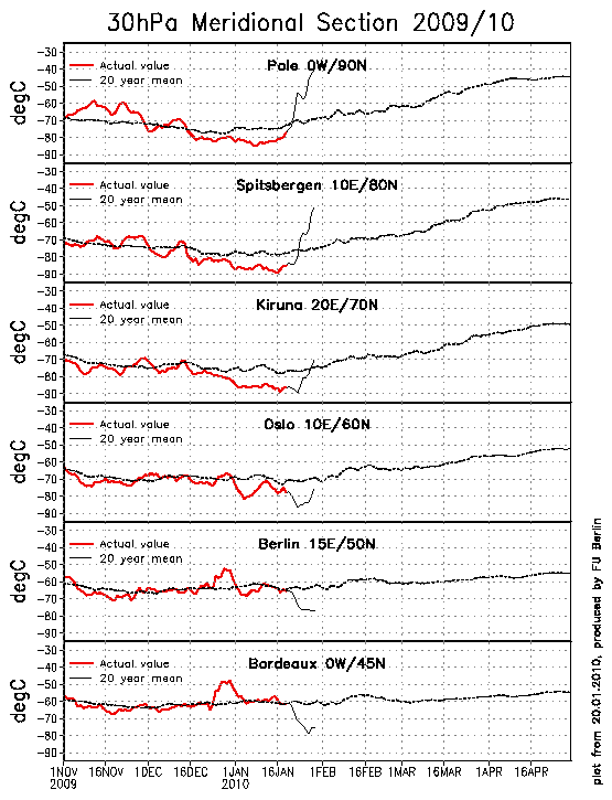
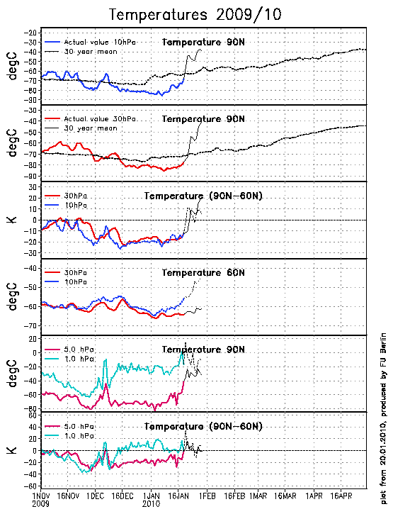
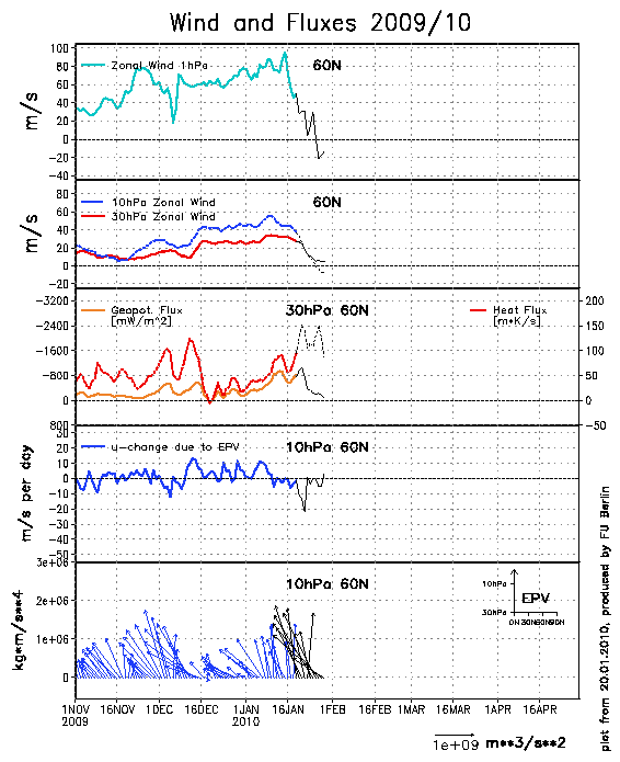
Ik citeer van netweather
Whether this materialises as a high pressure towards the UK is unknown, as residual energy in the troposphere and the effects of the MJO will have an impact. My feeling is that we will have the potential for a blocked pattern slowly moving eastwards over a period of about 2 weeks. I doubt whether models will handle this too well at this range as it will be against the historic norms which are pre loaded into the forecasts.
+
The jetstream will be shoved well south again come Feb after a temporary buckle last week of Jan due to the magnetic disturbances of the sun. This will see AZH ridge north and get absorbed into GHP/Arctic HP and I thin N to NE'ly winds will dominate first 10days+ of Feb before a migration east of the HP cell to Scandi. It is correct to not need a SSW/MMW that propogates downward to bring cold setup. As has been pointed out we have had sever cold this winter without one.
„Et nul ne se connait tant qu'il n'a pas souffert, „C'est une dure loi, mais une loi suprème, „Vieille comme le monde et la fatalité, „Qu'l nous faut du malheur regevoir le baptéme, ~Et qu'a ce triste prix tout doit étre acheté. „Les moissons pour murir out besoin de rosée, „Pour vivre et pour sentir l'homme a besoin de pleura, „La joie a pour symbole une plante brisée, „Humide encore de pluie et couverte de fleurs."