Volgens de onderstaande analyse maken we een goede kans op een flinke periode met koud weer.
First good indication of propagation from the upper layers.
Heat flux at 60N shows negative values -10 km/s:
http://acdb-ext.gsfc.nasa.gov/Data_services/met/metdata/annual/vtn_150_2009.pdf
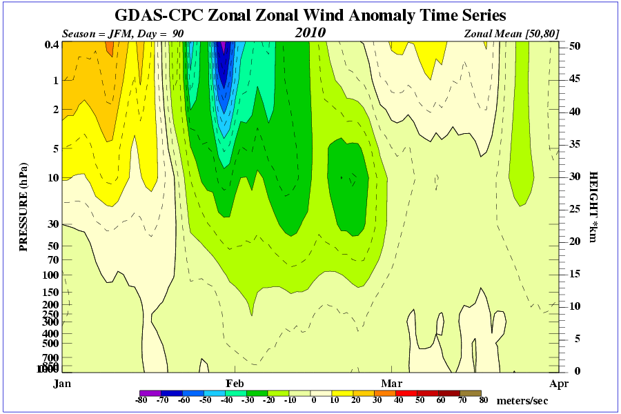
Zonal wind anomalies to -20 m/s permeating down to 300 hPa:
http://www.cpc.ncep.noaa.gov/products/stratosphere/strat-trop/gif_files/time_pres_UGRD_ANOM_JFM_NH_2010.gif
These are very good for blocking structures to form at 60N.
Relative angular momentum leaving out the QBO signal has gone off the scale thanks to growing momentum in the tropics:
http://www.esrl.noaa.gov/psd/map/images/reanalysis/aam_total/glaam.sig1-21.90day.gif
The GWO has responded with a high amplitude phase 5 orbit (signal blocking to our north):
http://www.esrl.noaa.gov/psd/map/images/gcm/gwo_40d.gif
Both frictional and mountain torques are positive. There is some scope for the Asian Mountain Torque to deliver the icing on the cake here and shoot tendency in relative angular momentum to an extreme value. That will prolong the duration in phase 5.
So definate support for cold, indeed very cold. The positioning of the high is still open to doubt beyond day 5 but looking very positive for the third cold wave of the winter.
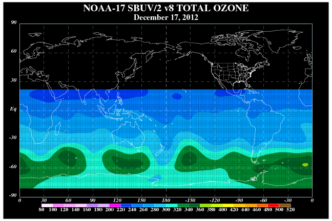
Finally, another positive, stratospheric ozone concentrations are huge across large parts of the northern hemisphere mid and high latitudes. They are also falling across the tropics once more, similar to mid December:
http://www.cpc.ncep.noaa.gov/products/stratosphere/sbuv2to/gif_files/sbuv17_ll_latest.gif
Bron netweather
Quote selectie