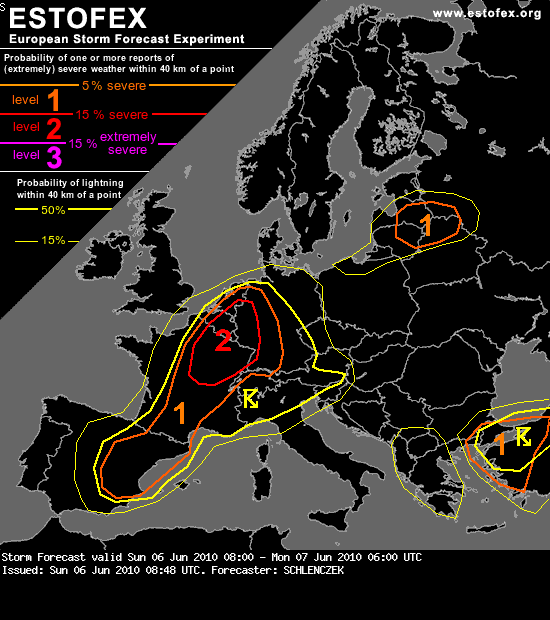
...E-central France, S Benelux, W / SW Germany...
Ahead of an upper shortwave trough, warm and moist air is advected into parts of east-central France, Benelux and W Germany. CAPE is forecast to be in a range of 1000 - 2000 J/kg in an environment with 10 - 15 m/s deep layer shear, locally up to 20 m/s. In the eastern parts of this discussion part, the airmass is capped and convective initiation is expected to occur in the late afternoon. Most storms over eastern France tend to become multicellular and may merge into a linear MCS. The main threat is expected to be large hail and severe wind gusts. Ahead of this system, some isolated storms may become supercellular, posing a threat of large hail and severe wind gusts. A tornado is not ruled out as LCL heights should be in a range of 800 - 1500m AGL and LLS may be locally enhanced. The large hail / tornado threat should diminish in the late evening hours as most CAPE is surface-based.
 Een stevig onweer is zeer welkom