NASA Eyeing Igor's Eye, Bermuda Under Warning
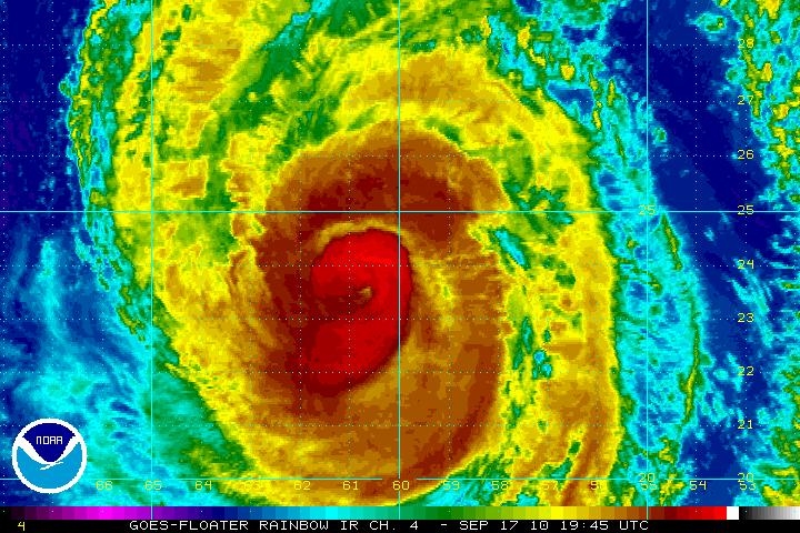
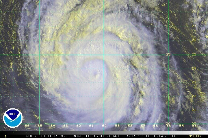
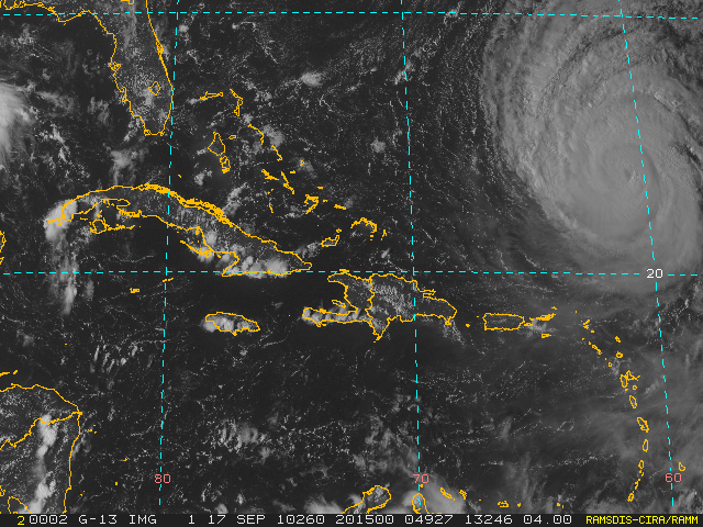
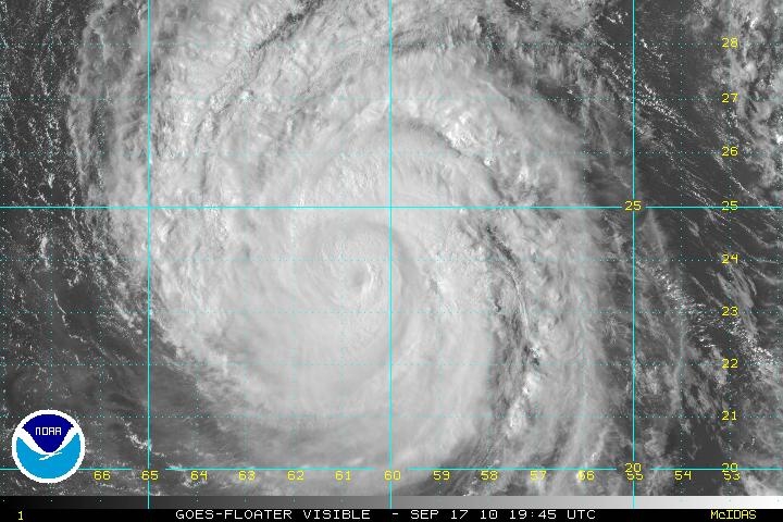
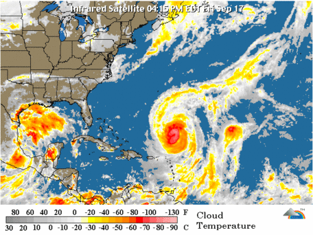
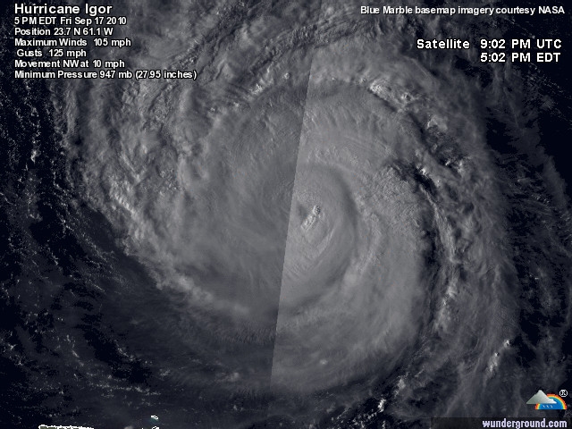
NASA's Aqua and Terra satellites kept a close eye on Hurricane Igor's eye, and noticed some differences in the storm. Infrared and visible imagery from these two NASA satellites noticed that Igor's eye was undergoing some changes. Meanwhile, Bermuda residents are eyeing Igor and are now under a hurricane warning as the storm approaches.
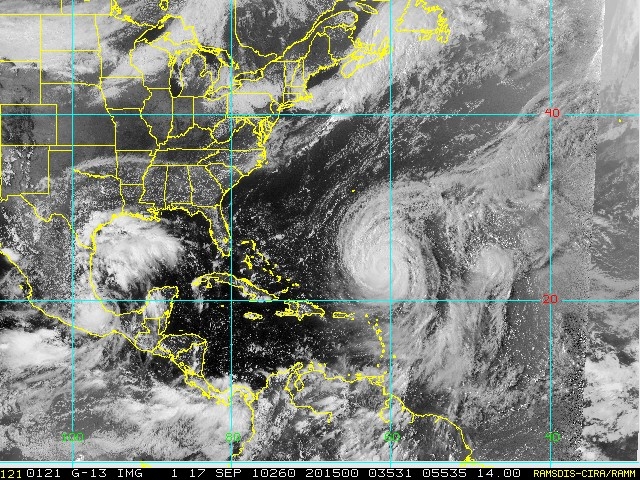
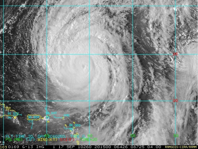
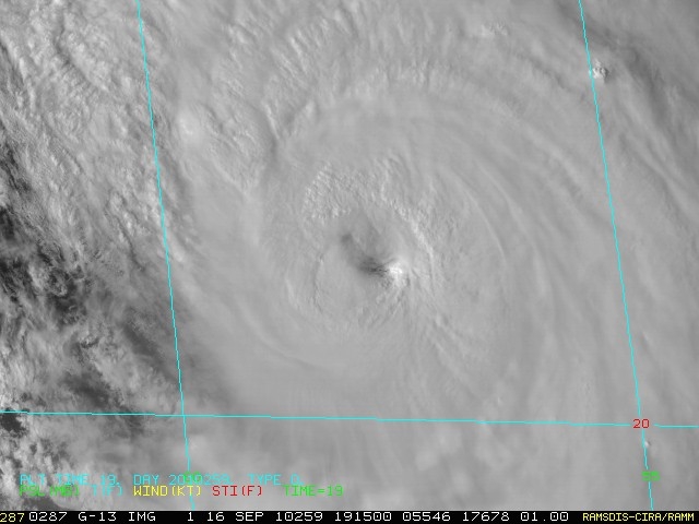
When NASA's Terra satellite flew over Hurricane Igor at 10:50 a.m. EDT on Sept. 17 the Moderate Resolution Imaging Spectroradiometer (MODIS) instrument captured a visible image of the storm. The image showed that Igor's eye was cloud-filled at the time.
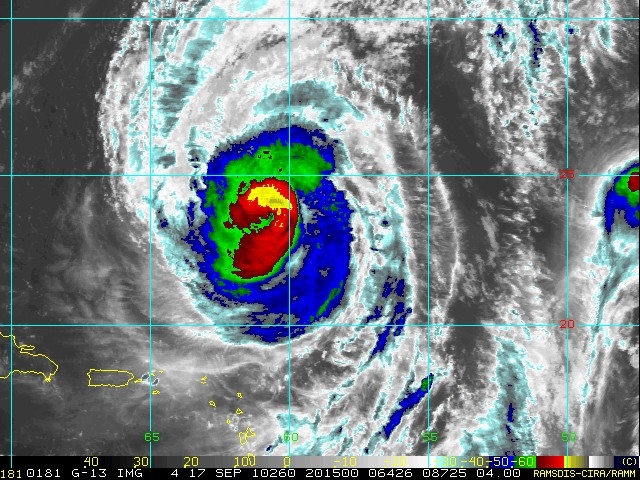
Earlier in the day, at 1:17 a.m. EDT, when NASA's Aqua satellite passed over Igor from its orbit in space, it captured an infrared image of Igor's eye. The Atmospheric Infrared Sounder (AIRS) instrument data showed that Igor's eye was not centered within the body of the storm. The National Hurricane Center in Miami, Fla. noted that the "inner eyewall is partially broken to the west."
On Sept. 16, the Tropical Rainfall Measuring Mission satellite (TRMM) flew over Igor and captured a large area of heavy rainfall (falling at about 2 inches per hour) north of Igor's eye. Much of the rainfall within Igor at the time appeared to be moderate, falling at rates between .78 to 1.57 inches per hour.
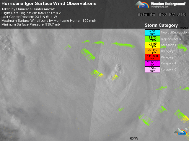
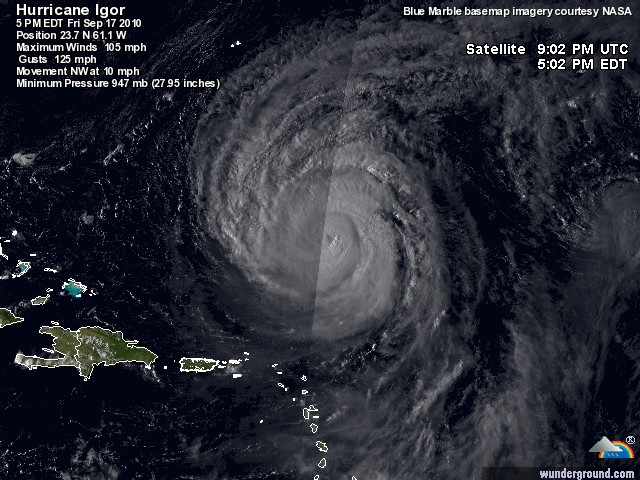
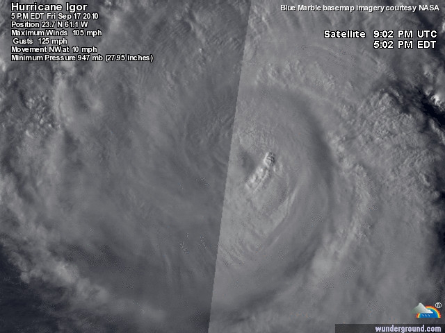
On Sept. 17 at 2 p.m. EDT, Bermuda was under a hurricane warning. At that time, Igor's maximum sustained winds had decreased to near 115 mph, but the National Hurricane Center noted that some strengthening is possible in the next day or two as Igor nears Bermuda. Igor is a category three hurricane on the Saffir-Simpson Hurricane Wind Scale. Igor's center was about 655 miles south-southeast of Bermuda near 23.4 North and 60.7 West. It was moving northwest near 9 mph, and had a minimum central pressure of 946 millibars.
Igor has grown in size over the last couple of days. Hurricane force winds now extend outward up to 105 miles from the center and tropical storm force winds extend outward up to 290 miles from the center, making Igor even more "monstrous" at almost 600 miles in diameter.
Bermuda can expect tropical storm conditions late Saturday, with hurricane conditions expected on Sunday, according to the National Hurricane Center. Dangerous surf conditions will also build as Igor approaches.
Igor's huge size and power are stirring up a lot of rough surf in the Atlantic Ocean. Large swells will continue to affect the Leeward Islands, Puerto Rico, the Virgin Islands, Hispaniola and portions of the Bahamas and will continue over the next couple of days. In addition, large ocean swells will create dangerous surf and rip currents along the U.S. East Coast through the weekend.
Text credit: Rob Gutro, NASA's Goddard Space Flight Center, Greenbelt, Md.
The AIRS instrument on NASA's Aqua satellite captured an infrared image of Hurricane Igor on Sept. 17 at 5:17 UTC (1:17 a.m. EDT) and it appears that the eye of the storm is not centered within the body of it. Credit: NASA JPL, Ed Olsen

This visible image of Hurricane Igor was captured by the MODIS instrument on NASA's Terra satellite at 10:50 a.m. EDT on Sept. 17, and shows that Igor's eye was cloud-filled at the time. Credit: NASA Goddard/MODIS Rapid Response Team

TRMM captured a large area of heavy rainfall (falling at about 2 inches per hour) in the area north of Hurricane Igor's eye (red) on Sept. 16. The yellow and green areas indicate moderate rainfall between .78 to 1.57 inches per hour. Credit: NASA/SSAI, Hal Pierce

NASA's 3-D Look into Hurricane Igor's Heavy Rainfall
NASA's Tropical Rainfall Measuring Mission (TRMM) satellite has provided a 3-D look at the power "under the hood" (of clouds) in powerful Category 4 Hurricane Igor as it heads toward Bermuda. In the meantime, Igor is creating dangerous surf in the eastern Atlantic, and it will affect the U.S. East coast later today. Igor is an extremely dangerous category four hurricane on the Saffir-Simpson hurricane wind scale today, Sept. 16, and he is expected to remain a large and powerful hurricane over the next several days.
The TRMM satellite, operated by NASA and the Japanese Space Agency covers the tropics daily, and provides two dimensional views of rainfall rates within a tropical cyclone. TRMM data are also used to give forecasters a 3 dimensional look at a storm's cloud heights and rainfall, which are extremely helpful in forecasting. The National Hurricane Center in Miami, Fla. who does the forecasting for tropical cyclones utilizes TRMM data in their forecasts.
A 3-D image was created by Hal Pierce at NASA's Goddard Space Flight Center, Greenbelt, Md. using data from TRMM's Precipitation Radar (PR) instrument on Sept. 15 at 0353 UTC (Sept. 14 at 11:53 p.m. EDT). The image revealed towering clouds, or "hot towers" over 15 kilometers (9 miles) high. Those high hot towers are an indication of a strong storm.
The 3-D image also showed that Igor's eye was still very distinct but the southwestern portion of the eye wall had eroded. In addition, the image showed a large area of heavy rainfall, falling at about 2 inches per hour. For more information about how TRMM looks at rainfall, visit NASA's TRMM website at: http://trmm.gsfc.nasa.gov/. TRMM is a joint mission between NASA and the Japanese space agency JAXA.
At 5 a.m. EDT on Sept. 16, Igor's winds had increased back up to 145 mph. It was located about 440 miles east-northeast of the Northern Leeward Islands, which is about 955 miles south-southeast of Bermuda. Igor's center was near 20.5 North and 56.8 West. Igor's estimated minimum central pressure is 929 millibars. Igor is moving toward the west-northwest near 7 mph and a turn toward the northwest and an increase in forward speed are expected over the next couple of days, according to the National Hurricane Center. Igor continues to be a huge hurricane. Hurricane winds extend out 70 miles from his center, and tropical storm force winds extend out 275 from his center, about the same distance as they were on Sept. 15.
Because Igor is so powerful and so large, he's generating large swells at sea that are currently affecting the Leeward Islands, Puerto Rico and the Virgin Islands. Those large swells and dangerous surf are expected in the Bahamas today and through the weekend. Igor's dangerous surf will also reach the East Coast of the United States later today and last through the weekend. That means trouble for beachgoers as these swells cause heavy surf and rip tides.
When Hurricane Earl brushed the U.S. East Coast in the first week of September it created the same surf conditions expected with Igor. Over a weekend as Earl lingered, more than 100 people were rescued off of the Delaware, Maryland and New Jersey beaches because of deadly rip tides.
Text credit: Rob Gutro, NASA's Goddard Space Flight Center, Greenbelt, Md.
This 3-D image of Igor's cloud heights and rainfall from NASA TRMM data shows a large area of heavy rainfall (falling at about 2 inches per hour) shown here in red on Sept. 15 at 0353 UTC. The yellow and green areas indicate moderate rainfall between .78 to 1.57 inches per hour. The image reveals that Igor's eye was still very distinct but the southwestern portion of the eye wall had eroded.

TRMM captured a large area of heavy rainfall (falling at about 2 inches per hour) shown here in red, occurring in Hurricane Igor on Sept. 15 at 0353 UTC (Sept. 14 at 11:53 p.m. EDT). The yellow and green areas indicate moderate rainfall between .78 to 1.57 inches per hour.

Voor het Archief:
NASA's Aqua and Terra satellites kept a close eye on Hurricane Igor's eye, and noticed some differences in the storm. Infrared and visible imagery from these two NASA satellites noticed that Igor's eye was undergoing some changes. Meanwhile, Bermuda residents are eyeing Igor and are now under a hurricane warning as the storm approaches.
When NASA's Terra satellite flew over Hurricane Igor at 10:50 a.m. EDT on Sept. 17 the Moderate Resolution Imaging Spectroradiometer (MODIS) instrument captured a visible image of the storm. The image showed that Igor's eye was cloud-filled at the time.
Earlier in the day, at 1:17 a.m. EDT, when NASA's Aqua satellite passed over Igor from its orbit in space, it captured an infrared image of Igor's eye. The Atmospheric Infrared Sounder (AIRS) instrument data showed that Igor's eye was not centered within the body of the storm. The National Hurricane Center in Miami, Fla. noted that the "inner eyewall is partially broken to the west."
On Sept. 16, the Tropical Rainfall Measuring Mission satellite (TRMM) flew over Igor and captured a large area of heavy rainfall (falling at about 2 inches per hour) north of Igor's eye. Much of the rainfall within Igor at the time appeared to be moderate, falling at rates between .78 to 1.57 inches per hour.
On Sept. 17 at 2 p.m. EDT, Bermuda was under a hurricane warning. At that time, Igor's maximum sustained winds had decreased to near 115 mph, but the National Hurricane Center noted that some strengthening is possible in the next day or two as Igor nears Bermuda. Igor is a category three hurricane on the Saffir-Simpson Hurricane Wind Scale. Igor's center was about 655 miles south-southeast of Bermuda near 23.4 North and 60.7 West. It was moving northwest near 9 mph, and had a minimum central pressure of 946 millibars.
Igor has grown in size over the last couple of days. Hurricane force winds now extend outward up to 105 miles from the center and tropical storm force winds extend outward up to 290 miles from the center, making Igor even more "monstrous" at almost 600 miles in diameter.
Bermuda can expect tropical storm conditions late Saturday, with hurricane conditions expected on Sunday, according to the National Hurricane Center. Dangerous surf conditions will also build as Igor approaches.
Igor's huge size and power are stirring up a lot of rough surf in the Atlantic Ocean. Large swells will continue to affect the Leeward Islands, Puerto Rico, the Virgin Islands, Hispaniola and portions of the Bahamas and will continue over the next couple of days. In addition, large ocean swells will create dangerous surf and rip currents along the U.S. East Coast through the weekend.
Text credit: Rob Gutro, NASA's Goddard Space Flight Center, Greenbelt, Md.
The AIRS instrument on NASA's Aqua satellite captured an infrared image of Hurricane Igor on Sept. 17 at 5:17 UTC (1:17 a.m. EDT) and it appears that the eye of the storm is not centered within the body of it. Credit: NASA JPL, Ed Olsen
This visible image of Hurricane Igor was captured by the MODIS instrument on NASA's Terra satellite at 10:50 a.m. EDT on Sept. 17, and shows that Igor's eye was cloud-filled at the time. Credit: NASA Goddard/MODIS Rapid Response Team
TRMM captured a large area of heavy rainfall (falling at about 2 inches per hour) in the area north of Hurricane Igor's eye (red) on Sept. 16. The yellow and green areas indicate moderate rainfall between .78 to 1.57 inches per hour. Credit: NASA/SSAI, Hal Pierce
NASA's 3-D Look into Hurricane Igor's Heavy Rainfall
NASA's Tropical Rainfall Measuring Mission (TRMM) satellite has provided a 3-D look at the power "under the hood" (of clouds) in powerful Category 4 Hurricane Igor as it heads toward Bermuda. In the meantime, Igor is creating dangerous surf in the eastern Atlantic, and it will affect the U.S. East coast later today. Igor is an extremely dangerous category four hurricane on the Saffir-Simpson hurricane wind scale today, Sept. 16, and he is expected to remain a large and powerful hurricane over the next several days.
The TRMM satellite, operated by NASA and the Japanese Space Agency covers the tropics daily, and provides two dimensional views of rainfall rates within a tropical cyclone. TRMM data are also used to give forecasters a 3 dimensional look at a storm's cloud heights and rainfall, which are extremely helpful in forecasting. The National Hurricane Center in Miami, Fla. who does the forecasting for tropical cyclones utilizes TRMM data in their forecasts.
A 3-D image was created by Hal Pierce at NASA's Goddard Space Flight Center, Greenbelt, Md. using data from TRMM's Precipitation Radar (PR) instrument on Sept. 15 at 0353 UTC (Sept. 14 at 11:53 p.m. EDT). The image revealed towering clouds, or "hot towers" over 15 kilometers (9 miles) high. Those high hot towers are an indication of a strong storm.
The 3-D image also showed that Igor's eye was still very distinct but the southwestern portion of the eye wall had eroded. In addition, the image showed a large area of heavy rainfall, falling at about 2 inches per hour. For more information about how TRMM looks at rainfall, visit NASA's TRMM website at: http://trmm.gsfc.nasa.gov/. TRMM is a joint mission between NASA and the Japanese space agency JAXA.
At 5 a.m. EDT on Sept. 16, Igor's winds had increased back up to 145 mph. It was located about 440 miles east-northeast of the Northern Leeward Islands, which is about 955 miles south-southeast of Bermuda. Igor's center was near 20.5 North and 56.8 West. Igor's estimated minimum central pressure is 929 millibars. Igor is moving toward the west-northwest near 7 mph and a turn toward the northwest and an increase in forward speed are expected over the next couple of days, according to the National Hurricane Center. Igor continues to be a huge hurricane. Hurricane winds extend out 70 miles from his center, and tropical storm force winds extend out 275 from his center, about the same distance as they were on Sept. 15.
Because Igor is so powerful and so large, he's generating large swells at sea that are currently affecting the Leeward Islands, Puerto Rico and the Virgin Islands. Those large swells and dangerous surf are expected in the Bahamas today and through the weekend. Igor's dangerous surf will also reach the East Coast of the United States later today and last through the weekend. That means trouble for beachgoers as these swells cause heavy surf and rip tides.
When Hurricane Earl brushed the U.S. East Coast in the first week of September it created the same surf conditions expected with Igor. Over a weekend as Earl lingered, more than 100 people were rescued off of the Delaware, Maryland and New Jersey beaches because of deadly rip tides.
Text credit: Rob Gutro, NASA's Goddard Space Flight Center, Greenbelt, Md.
This 3-D image of Igor's cloud heights and rainfall from NASA TRMM data shows a large area of heavy rainfall (falling at about 2 inches per hour) shown here in red on Sept. 15 at 0353 UTC. The yellow and green areas indicate moderate rainfall between .78 to 1.57 inches per hour. The image reveals that Igor's eye was still very distinct but the southwestern portion of the eye wall had eroded.
TRMM captured a large area of heavy rainfall (falling at about 2 inches per hour) shown here in red, occurring in Hurricane Igor on Sept. 15 at 0353 UTC (Sept. 14 at 11:53 p.m. EDT). The yellow and green areas indicate moderate rainfall between .78 to 1.57 inches per hour.
Voor het Archief:
@wthus (Twitter/Insta/Vero/Facebook) | Keerl, e-j zol eens wat meer moet’n doetinchemm’n | Bezoek ook: www.weerstation-dichteren.nl | www.buurmaaktnatuur.nl