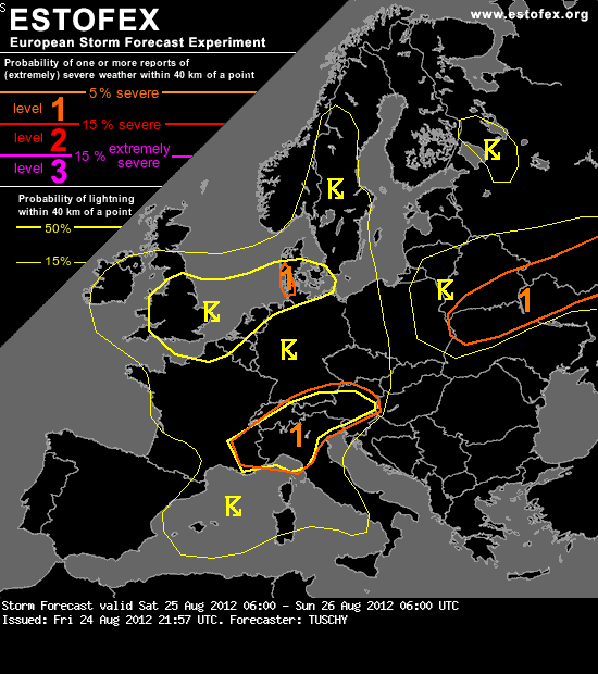
ESTOFEX: Geen level voor de Benelux, wel onweerskans en ...
Bericht van: Hans (Diemen) , 25-08-2012 01:03
... misschien toch georganiseerde buien. De daarvoor positievere zinnen heb ik vet gemaakt.
... France, Benelux and parts of Denmark ...
A well mixed maritime air mass from the Atlantic and moderate mid-level lapse rates due to cooler air at 500 hPa cause widespread low-end SBCAPE build-up in the order of 300-600 J/kg. A short time frame exists during the late afternoon hours, where LL winds increase and some CAPE still exists. A few better organized showers/thunderstorms are possible with marginal hail and strong wind gusts. Despite low LCLs (especially over N-France and Benelux), directional shear remains too weak to including an isolated tornado risk for now. After sunset, LL shear rapidly increases over N-France, but CAPE vanishes, so thunderstorm probabilities decay after sunset. However, isolated storms continue offshore over the S-North Sea and the E-English Channel. Storms, which move ashore along the coasts of Belgium/the Netherlands, NW Germany and W-Denmark may become temporarily better organized, as LL shear increases onshore. Main concern however is a potential heavy rainfall risk during the second part of the night with organized shower streets building over the extreme SE North Sea towards SW Denmark. A level 1 for rain was issued. This risk continues beyond the forecast range and expands S-wards.
Bericht laatst bijgewerkt: 25-08-2012 01:04