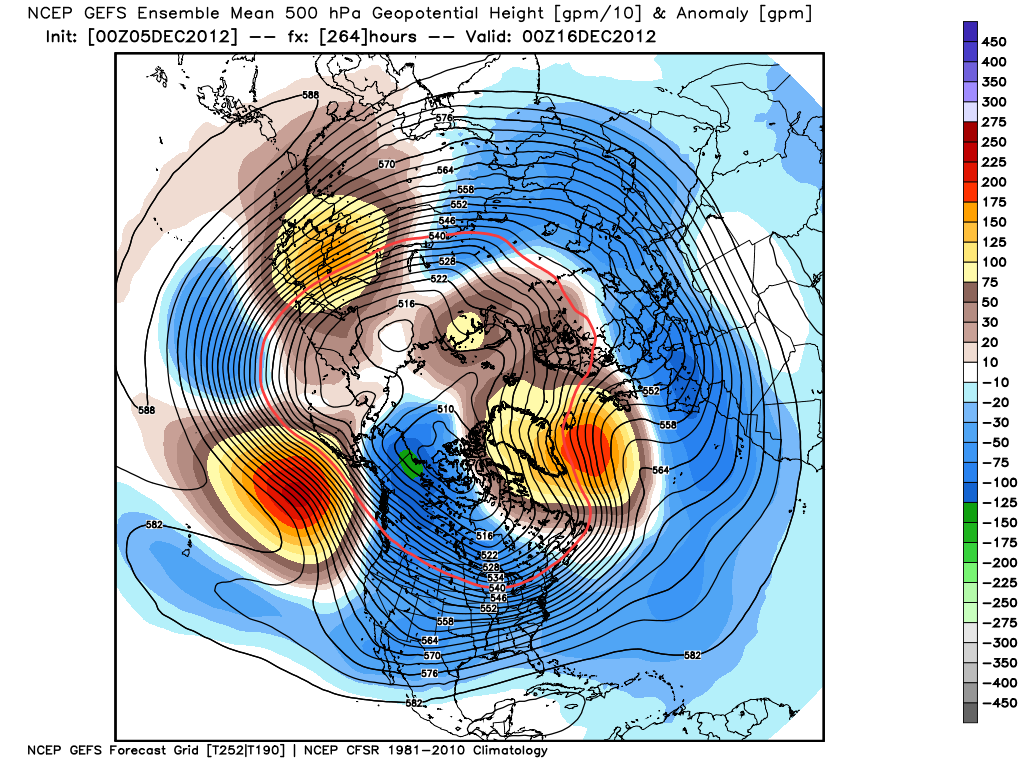
The trend for vortex shift towards Siberia gathers apace. This should assist in retrogressing the ridge over Scandinavia towards Greenland in the extended range. GEFS mean hight anomalies depicting an amplification of the North Pacific ridge which teleconnects to height rises over southern Greenland.
The only complicating factor remains the modelling of a cut off section of the pv over NE Siberia and its movement across the North Pacific.
I suspect the background factors will sharpen the ridge development around Iceland and maintain this, meaining the retrogression (if and when) will have an axis around a quasi Greenland-Iceland-N.Sea block, possibly extending into Norway and dropping through Finland (and then hopefully SW though northern Europe).
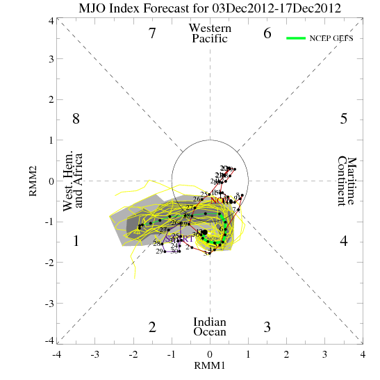
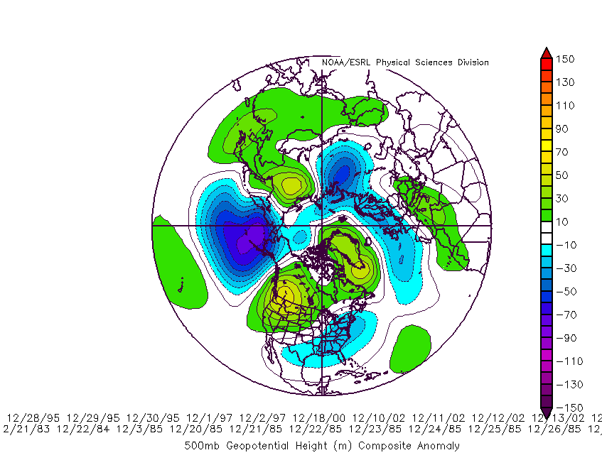
Aanwijzing daarvoor zou kunnen zijn dat de MJO richting fase 1 gaat, de teleconnectie daarvan is met een Groenlandhoog. GFS zeer lange termijn laat Groenlandhoog zien. Naar ik verwacht zien we komende runs (over paar dagen) Scandiblok richting Groenland. Met wat geluk komt dan de echt koude lucht binnen voordat we geconfronteerd worden met lucht uit het noorden. Misschien een uitloper richting Scandinavie?
Quote selectie
The only complicating factor remains the modelling of a cut off section of the pv over NE Siberia and its movement across the North Pacific.
I suspect the background factors will sharpen the ridge development around Iceland and maintain this, meaining the retrogression (if and when) will have an axis around a quasi Greenland-Iceland-N.Sea block, possibly extending into Norway and dropping through Finland (and then hopefully SW though northern Europe).
Aanwijzing daarvoor zou kunnen zijn dat de MJO richting fase 1 gaat, de teleconnectie daarvan is met een Groenlandhoog. GFS zeer lange termijn laat Groenlandhoog zien. Naar ik verwacht zien we komende runs (over paar dagen) Scandiblok richting Groenland. Met wat geluk komt dan de echt koude lucht binnen voordat we geconfronteerd worden met lucht uit het noorden. Misschien een uitloper richting Scandinavie?
Quote selectie
„Et nul ne se connait tant qu'il n'a pas souffert, „C'est une dure loi, mais une loi suprème, „Vieille comme le monde et la fatalité, „Qu'l nous faut du malheur regevoir le baptéme, ~Et qu'a ce triste prix tout doit étre acheté. „Les moissons pour murir out besoin de rosée, „Pour vivre et pour sentir l'homme a besoin de pleura, „La joie a pour symbole une plante brisée, „Humide encore de pluie et couverte de fleurs."
