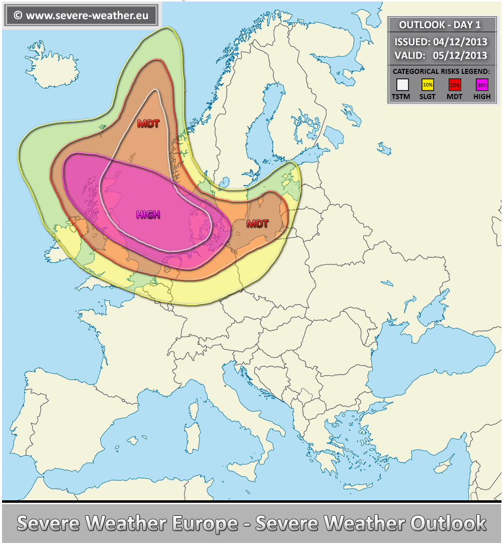
Waarschuwing Severe Weather Europe: high risk 05/12
Bericht van: Kevin (Tessenderlo) , 04-12-2013 20:08
Between the large ridge over WSW Europe and deep trough over NNW Europe, an explosive cyclogenesis takes place within the exit region of the powerful mid level jet. It develops north of UK and rapidly translates across the North Sea and Denmark towards Baltics on Thursday.
*** A significant windstorm “Xaver” is forecasted to take place on Thursday, bringing extreme damaging winds across the North sea and surrounding coastal areas of UK, Denmark and NW Germany ***
http://www.severe-weather.eu/outlooks-day1/outlook-day-1-valid-05122013/
Quote selectie
*** A significant windstorm “Xaver” is forecasted to take place on Thursday, bringing extreme damaging winds across the North sea and surrounding coastal areas of UK, Denmark and NW Germany ***
http://www.severe-weather.eu/outlooks-day1/outlook-day-1-valid-05122013/
Quote selectie