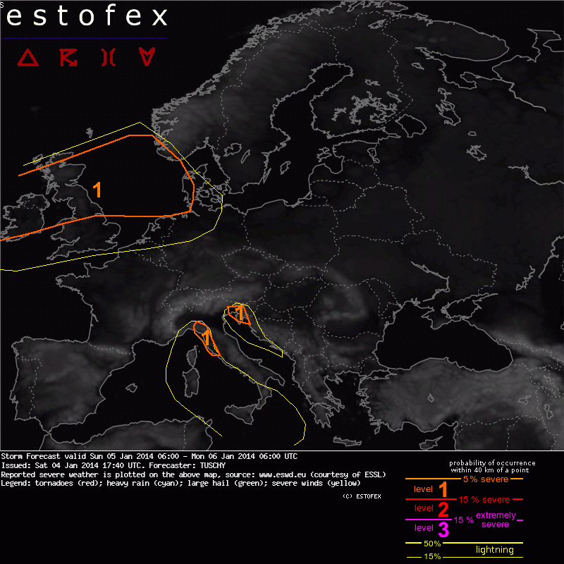
Storm Forecast
Valid: Sun 05 Jan 2014 06:00 to Mon 06 Jan 2014 06:00 UTC
Issued: Sat 04 Jan 2014 17:40
Forecaster: TUSCHY
.... ....
For Ireland, parts of the UK and Scotland yet another intense extratropical cyclone approaches from the west. Behind the eastward moving occlusion, a brisk westerly flow regime is forecast. 850 hPa winds increase to 20-30 m/s from W to E. No convection is forecast until noon (Ireland) and 18Z (UK).
This changes during the evening and overnight hours with the arrivial of a colder mid-layer air mass, enhanced BL moisture from a back-bent occlusion and numerous more or less pronounced mid-layer impulses. The strongest impulse likely crosses Ireland between 18-21Z and hits the North Sea between 00-06Z. Deeper updrafts with enhanced downward mixing are likely and as 850 hPa winds increase to aoa 30 m/s, severe to damaging wind gusts are once again forecast. This activity rapidly spreads east over the North Sea. There are some hints that once again convection could line up beneath those vorticity lobes (and attendant surface features), which could result in LEWP-ish structures. Concentrated swaths of severe wind gusts are possible with that kind of convection. Isolated tornadoes remain possible due to very strong BL shear and some LLCAPE (offshore and along westward facing coasts).
Between 00-06Z, isolated thunderstorms are also forecast over the SE North Sea, W-Denmark, the Netherlands and NW Germany. We kept the level 1 area offshore for now due to weakening forcing and warm EL temperatures. Strong to severe wind gusts will be the main hazard.
lees het hele verhaal hier http://www.estofex.org/