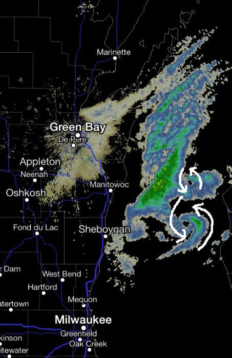
Radar Green Bay shows 2 Meso-Lows on Lake M
Bericht van: Ronald (Oak Creek, Wisconsin) , 23-01-2014 16:36
The image below is from the Green Bay NWS radar around 4:15am showing two distinct meso lows over the lake. Meso lows are small areas of low pressure formed due to shifting wind, in this case a northwest wind vs a northeast wind. Also a key contributor is the colder air moving over the warmer water. The unstable air rises and the result is a small area of low pressure, clouds and snow.
When a meso low moves over land the result is often a quick and intense burst of snow that can result in snowfall rates of 2"-3"+/hour.
Read more: http://www.wisn.com/weather/weather-blog-snow-up-next-on-deck-arctic-blast/-/9374846/24071494/-/4tw27mz/-/index.html#ixzz2rEhoCo3j
When a meso low moves over land the result is often a quick and intense burst of snow that can result in snowfall rates of 2"-3"+/hour.
Read more: http://www.wisn.com/weather/weather-blog-snow-up-next-on-deck-arctic-blast/-/9374846/24071494/-/4tw27mz/-/index.html#ixzz2rEhoCo3j
http://oakcreekwx.com