Mesoscale Discussion (Estofex) Alles toch wat oostelijker?
Bericht van: Bart (Oostakker) , 21-05-2014 16:40
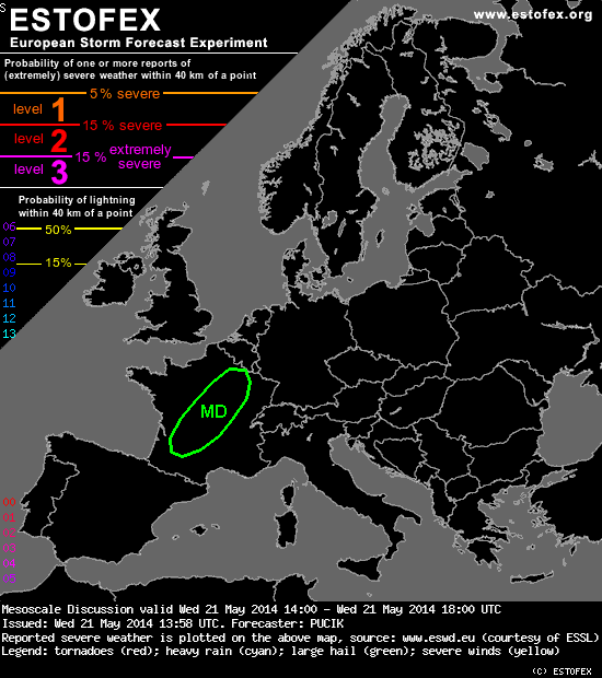
Mesoscale Discussion
Valid: Wed 21 May 2014 14:00 to Wed 21 May 2014 18:00 UTC
Issued: Wed 21 May 2014 13:58
Forecaster: PUCIK
Surface observations reveal easterly winds in the warm sector with dewpoints reaching 14 - 17 °C near the frontal boundary, which is in accordance with the model output. Thus, it is highly likely that several hundreds J/kg of CAPE have developed by this time. Barcelona and Bordeaux ascents show very strong southerly flow above 800 hPa, with windspeeds above 25 m/s. Taking into the consideration easterly surface flow, around 300 m2/s2 of SREH will be available to the storms. Combined with relatively low temperature - dew point spreads, conditions look prime for tornadoes.
However, radar observations confirm the tendency of the storms to quickly attain linear characteristics, paralleling the boundary, which will likely reduce the tornado risk to some extent. Nevertheless, especially in case some isolated cells manage to persist, tornadoes might occur, with even a strong event not ruled out. As storms continue to quickly cluster, severe wind gust and/or excessive precipitation threat will likely dominate the situation.
Valid: Wed 21 May 2014 14:00 to Wed 21 May 2014 18:00 UTC
Issued: Wed 21 May 2014 13:58
Forecaster: PUCIK
Surface observations reveal easterly winds in the warm sector with dewpoints reaching 14 - 17 °C near the frontal boundary, which is in accordance with the model output. Thus, it is highly likely that several hundreds J/kg of CAPE have developed by this time. Barcelona and Bordeaux ascents show very strong southerly flow above 800 hPa, with windspeeds above 25 m/s. Taking into the consideration easterly surface flow, around 300 m2/s2 of SREH will be available to the storms. Combined with relatively low temperature - dew point spreads, conditions look prime for tornadoes.
However, radar observations confirm the tendency of the storms to quickly attain linear characteristics, paralleling the boundary, which will likely reduce the tornado risk to some extent. Nevertheless, especially in case some isolated cells manage to persist, tornadoes might occur, with even a strong event not ruled out. As storms continue to quickly cluster, severe wind gust and/or excessive precipitation threat will likely dominate the situation.
Weerfoto's op mijn pagina www.facebook.com/madskiesbart