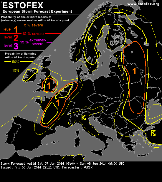
A level 1 was issued for France and BENELUX mainly for large hail and severe wind gusts.
... France towards BENELUX ...
Bordeaux 12 UTC Tuesday sounding captured the spread of EML towards the north. By 12 UTC Wednesday, EML will likely have overspread much of the region. There is a disagreement in models regarding the degree of low-level moisture - with GFS being the more aggresive one. Perhaps the best low-level moisture, based on the actual observations, will be available over S France. A significant difference in the values of CAPE between models, lack of apparent synoptic-scale forcing (apart from ill-defined frontal boundary) and influence of overnight convection make for a tough forecast for this region. Models agree on moderate to strong vertical wind shear, with DLS ranging from 15 (Netherlands) to 30 m/s (S France). However, shear vector should be parallel to the boundary, favouring storm clustering along the front. Regarding initiation, in the afternoon hours NW France and BENELUX will have higher odds of seeing a storm while towards the evening, some storms should initiate also over S and Central France. Again, much of this may also depend on the morning convection and leftover outflow boundaries. In scenario with much uncertainities, a broad Level 1 is introduced for the risk of well-organised DMC - multi or supercells capable of large hail and severe wind gusts.