kunnen mogelijk ook een tropische storm verwachten.
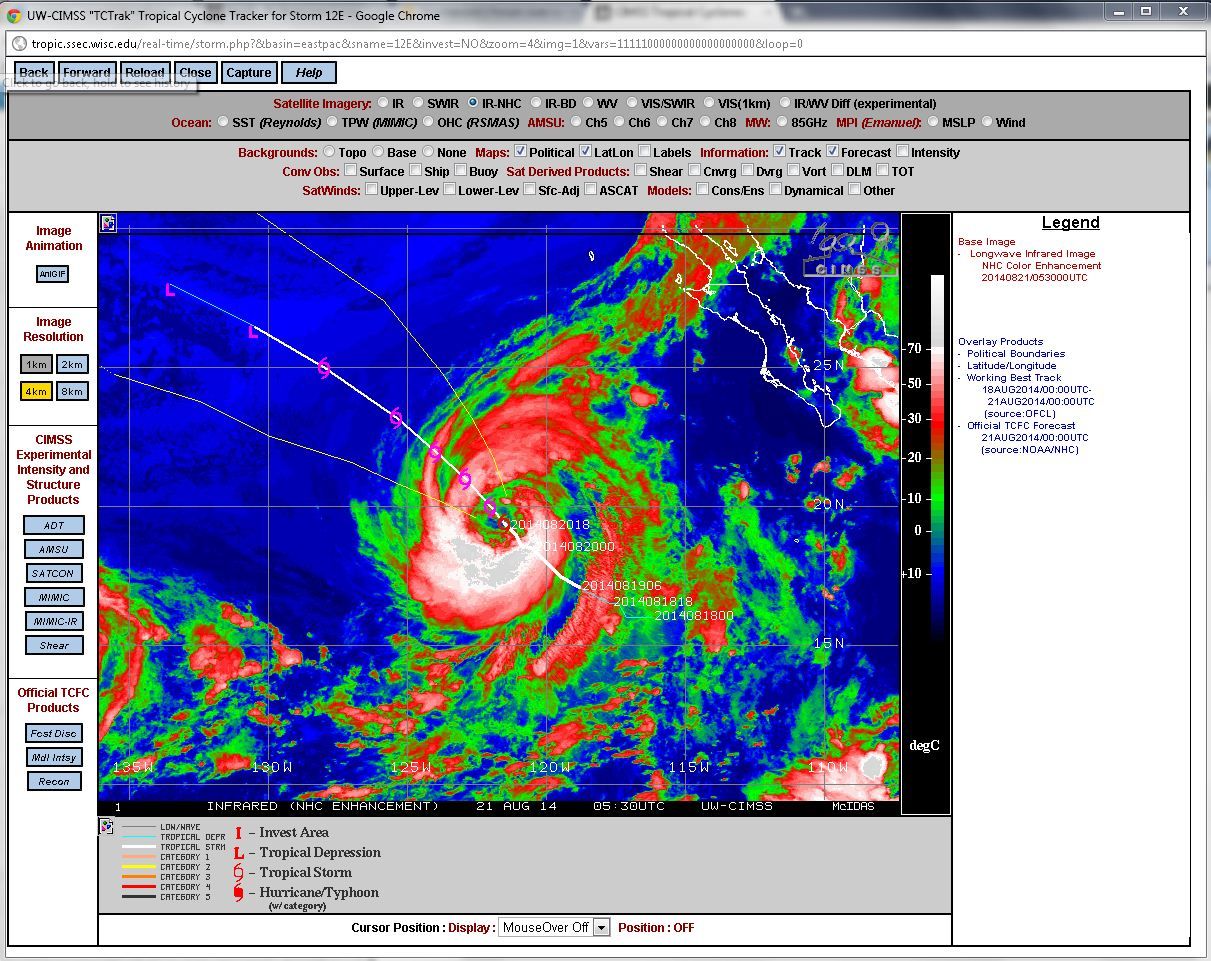
het oog hoort bij Lowell, in de east Pacific.
[QUOTE]TROPICAL STORM LOWELL DISCUSSION NUMBER 13
NWS NATIONAL HURRICANE CENTER MIAMI FL EP122014
800 PM PDT WED AUG 20 2014
Microwave imagery shows that Lowell has formed a ragged eye with a diameter of about 90 n mi, with conventional satellite imagery continuing to show a complex of convective bands wrapped around the
eye. Satellite intensity estimates from TAFB and SAB remain 55 kt, and there was a recent CIMSS AMSU estimate of 64 kt. The initial intensity remains 55 kt, although this could be a little conservative. The cirrus outflow remains good to excellent in all
directions.[/QUOTE]
Voor de Antillen:
[QUOTE]For the North Atlantic...Caribbean Sea and the Gulf of Mexico:
1. Showers and thunderstorms associated with an elongated area of low pressure located a few hundred miles east of the Windward Islands have changed little in organization during the past several hours. Environmental conditions are expected to be conducive for development during the next couple of days, and a
tropical depression could form while the system moves
west-northwestward at 10 to 15 mph across the Lesser Antilles and over the eastern Caribbean Sea.
..
[/QUOTE]
het oog hoort bij Lowell, in de east Pacific.
[QUOTE]TROPICAL STORM LOWELL DISCUSSION NUMBER 13
NWS NATIONAL HURRICANE CENTER MIAMI FL EP122014
800 PM PDT WED AUG 20 2014
Microwave imagery shows that Lowell has formed a ragged eye with a diameter of about 90 n mi, with conventional satellite imagery continuing to show a complex of convective bands wrapped around the
eye. Satellite intensity estimates from TAFB and SAB remain 55 kt, and there was a recent CIMSS AMSU estimate of 64 kt. The initial intensity remains 55 kt, although this could be a little conservative. The cirrus outflow remains good to excellent in all
directions.[/QUOTE]
Voor de Antillen:
[QUOTE]For the North Atlantic...Caribbean Sea and the Gulf of Mexico:
1. Showers and thunderstorms associated with an elongated area of low pressure located a few hundred miles east of the Windward Islands have changed little in organization during the past several hours. Environmental conditions are expected to be conducive for development during the next couple of days, and a
tropical depression could form while the system moves
west-northwestward at 10 to 15 mph across the Lesser Antilles and over the eastern Caribbean Sea.
..
[/QUOTE]