Veranderingen de komende weken en de SSW
Bericht van: Ronald (Oak Creek, Wisconsin) , 14-12-2014 22:47
Komende 2 weken flinke veranderingen w.o opwarming vd poolregio welke in 1e instantie voor Namer.van belang is (koude inval)
WeatherBELL Discussie dec 14 Joe D'Aleo
The 500mb anomalies on the models change drastically around the solstice, back to the November pattern.
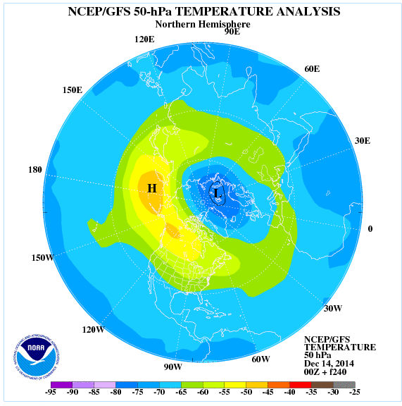
Note interestingly how the 10 day 50 mb temperature plot has warmth edging into the polar regions but with a plume through Canada where the ridge builds that delivers the cold.
The clasic example was 2009/10
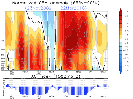
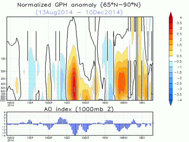
Note how each time polar atmosphere warms, the AO tanks.
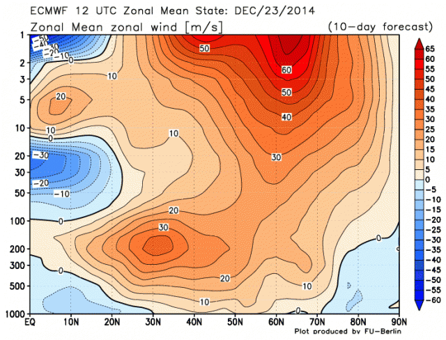
I don't anticipate that extreme but given the easterly QBO, El Nino and moderatly low solar I do expect a SSW. You can see the key levels of 30-50mb are blue meaning easterly anomalies where we measure the QBO (near the equator). It changes slowly so this will persist into the 2015 spring.
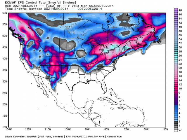
Here is the ensemble control run 360 hour snowfall total. It has two storms around the 19-21st and near Christmas. Interestingly a number of our analog years had snow around those dates and some another threat around the New Year.
WeatherBELL Discussie dec 14 Joe D'Aleo
The 500mb anomalies on the models change drastically around the solstice, back to the November pattern.
Note interestingly how the 10 day 50 mb temperature plot has warmth edging into the polar regions but with a plume through Canada where the ridge builds that delivers the cold.
The clasic example was 2009/10
Note how each time polar atmosphere warms, the AO tanks.
I don't anticipate that extreme but given the easterly QBO, El Nino and moderatly low solar I do expect a SSW. You can see the key levels of 30-50mb are blue meaning easterly anomalies where we measure the QBO (near the equator). It changes slowly so this will persist into the 2015 spring.
Here is the ensemble control run 360 hour snowfall total. It has two storms around the 19-21st and near Christmas. Interestingly a number of our analog years had snow around those dates and some another threat around the New Year.
http://oakcreekwx.com
