Hot, dry Euro Summer, Reboot: Joe D'Aleo's Analyse
Bericht van: Ronald (Oak Creek, Wisconsin) , 24-08-2015 00:16
The last 7 days has seen the latest heat surge which had followed a cool week shift to the east focused on Germany and then Poland
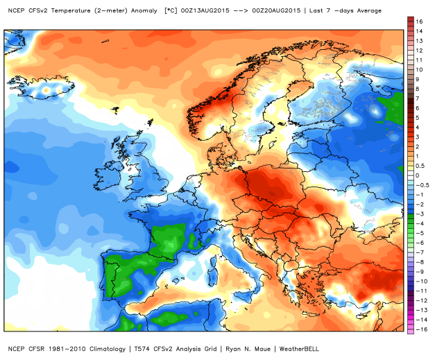
The summer has been cool to the north from the UK to Scandinavia to northwest Russia but warm to the south.
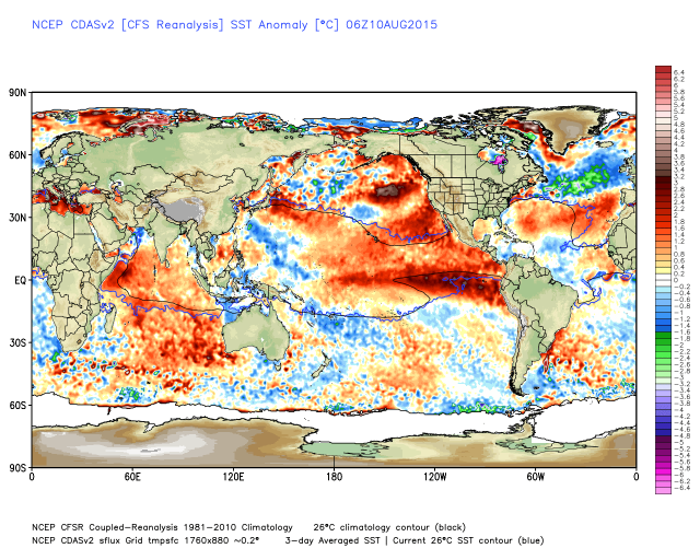
The pattern is driven by the orientation of the cold water north and warm south off Spain southwest into the central Atlantic.
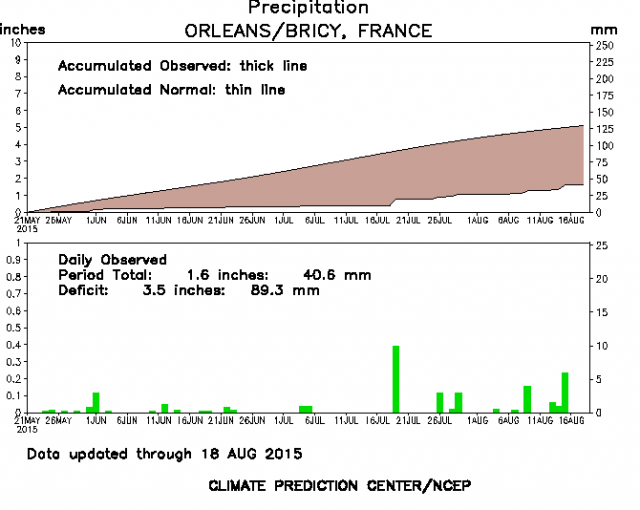
You can see the warmth coming in surges with a peek at Orleans in France and Berlin in Germany.
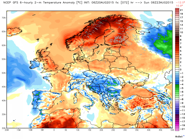
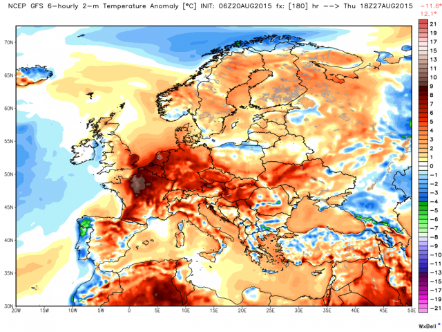
After cooler conditions withe the showers the next few days another warm period follows west late in the month.
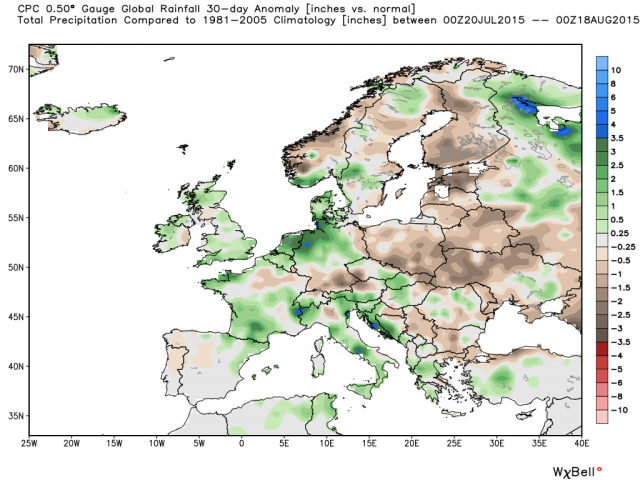
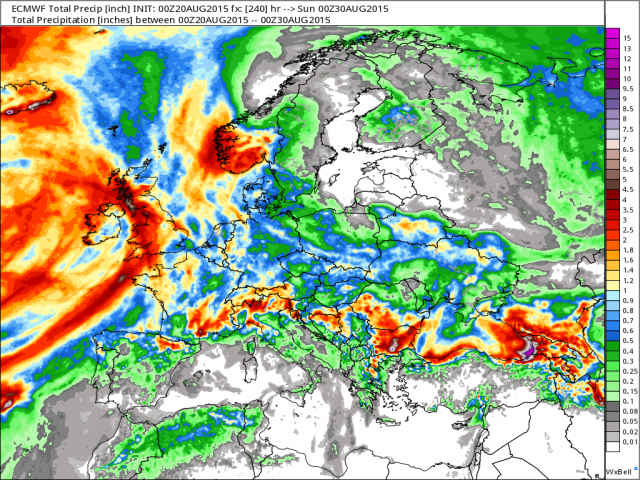
Rains increased central and west the last week and so for the month while the east stayed dry most notably in Poland, the Baltic States, Belarus and western Ukraine. It has ben wetter in northern Germany, the Netherlands and some other areas in the rest of western and southern Europe.
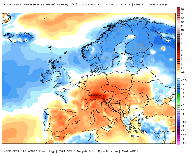
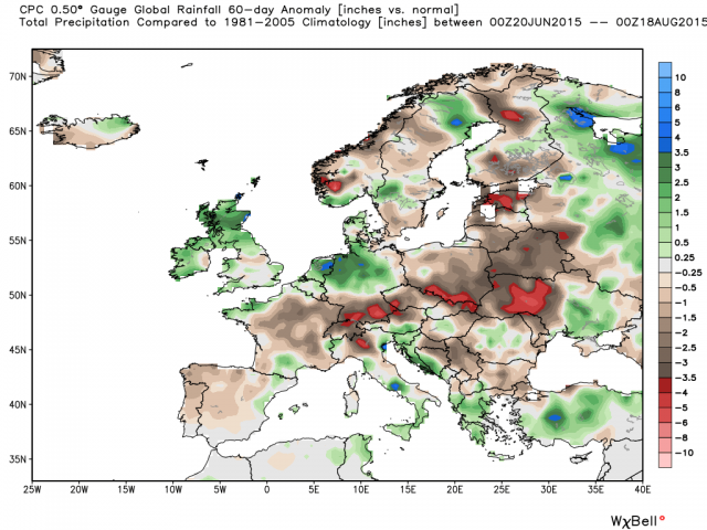
We see the same pattern, only amplified in the 60 day anomaly map.
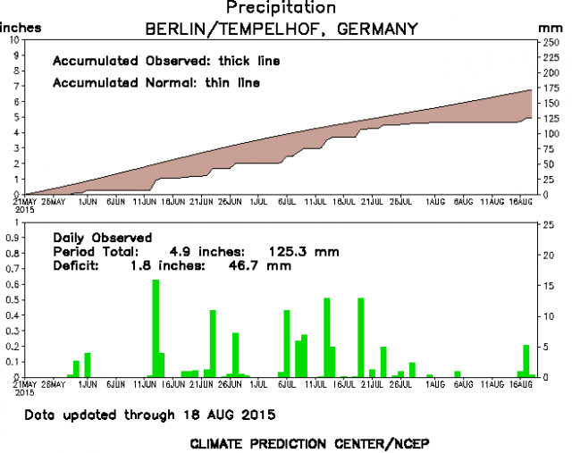
See the deficits in the 90 day charts for Orleans and Berlin.
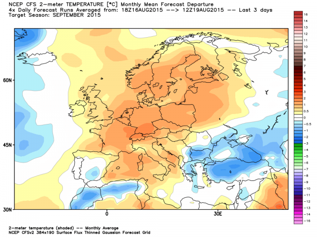
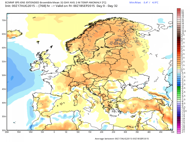
There is good agreement on a warm September CFS and EC except in the southeast.
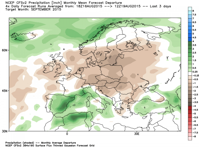
September is forecast dry north and wet south.
We will take an early look at the winter next week.
The summer has been cool to the north from the UK to Scandinavia to northwest Russia but warm to the south.
The pattern is driven by the orientation of the cold water north and warm south off Spain southwest into the central Atlantic.
You can see the warmth coming in surges with a peek at Orleans in France and Berlin in Germany.
After cooler conditions withe the showers the next few days another warm period follows west late in the month.
Rains increased central and west the last week and so for the month while the east stayed dry most notably in Poland, the Baltic States, Belarus and western Ukraine. It has ben wetter in northern Germany, the Netherlands and some other areas in the rest of western and southern Europe.
We see the same pattern, only amplified in the 60 day anomaly map.
See the deficits in the 90 day charts for Orleans and Berlin.
There is good agreement on a warm September CFS and EC except in the southeast.
September is forecast dry north and wet south.
We will take an early look at the winter next week.
http://oakcreekwx.com