Pas na tien november verandering van het stromingspatroon.
An overview of the latest EC32 output and a reminder this isn’t taken from the full suite.
The current projected analysis of HP just to the east linking to same to the SW and upper trough confined to the middle/western Atlantic is maintained, and possible briefly strengthened later, until around the 12th. With temps generally above average.
Between the 12th and the 18th a fairly rapid pattern change ensues with the dissipation of the HP cell to the east, the Atlantic trough to the NW becoming more active and a far more zonal flow bringing temps around average,
This continues until the end of the month bringing much more changeable weather to the UK, the specifics of which will depend on the latitudinal interplay between the cooler air to the NW and warmer to the SW. The sort of scenario that favours a north/south split over the UK with the north catching the brunt of the systems winging along although of course the south will not escape scot free.
Iets anders..
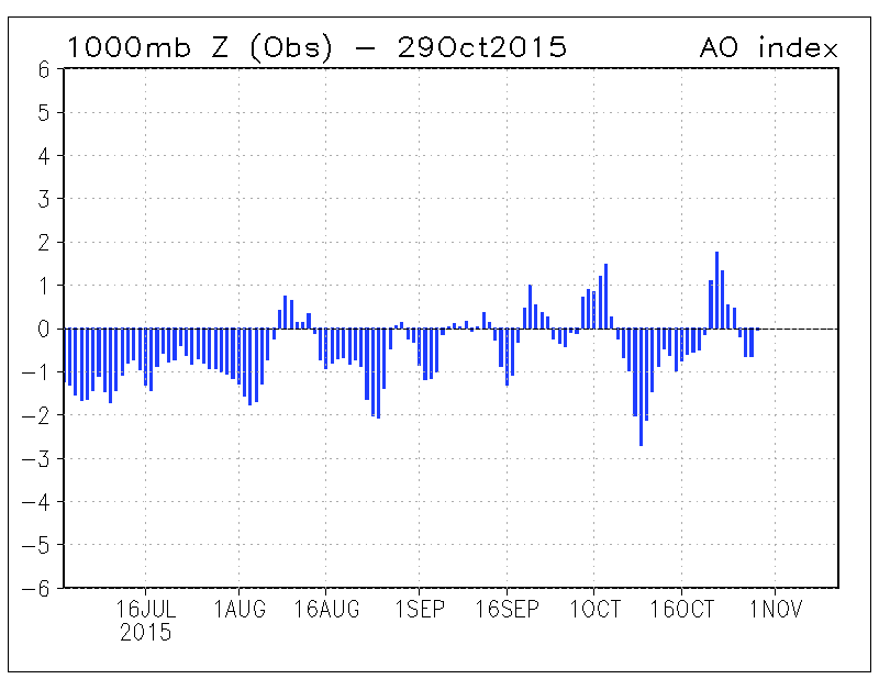
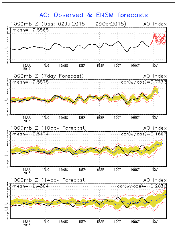
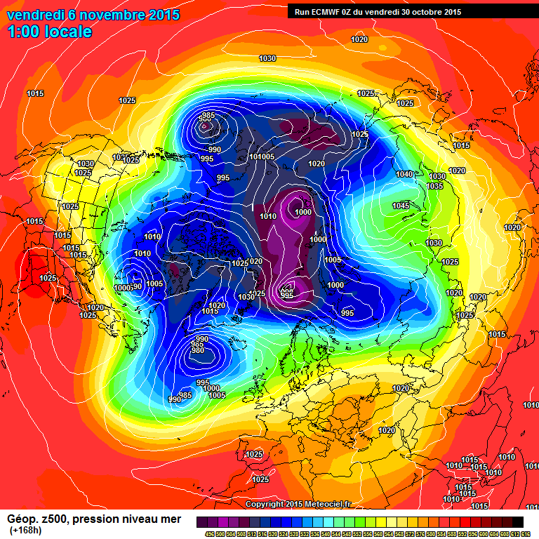
In Siberië stijgt langzamerhand de luchtdruk. Tijdlang zagen we een negatieve AO, nu transitie naar positieve AO. Zie onderste kaart. Hogedruk in Siberië zorgt er volgens Cohen voor dat de warmte naar de stratosfeer kan. Benieuwd wat hij daar zelf over te zeggen heeft a.s. maandag op zijn blog.
AO afgelopen maanden en verwachting. Dit laatst wijst duidelijk op positief!
An overview of the latest EC32 output and a reminder this isn’t taken from the full suite.
The current projected analysis of HP just to the east linking to same to the SW and upper trough confined to the middle/western Atlantic is maintained, and possible briefly strengthened later, until around the 12th. With temps generally above average.
Between the 12th and the 18th a fairly rapid pattern change ensues with the dissipation of the HP cell to the east, the Atlantic trough to the NW becoming more active and a far more zonal flow bringing temps around average,
This continues until the end of the month bringing much more changeable weather to the UK, the specifics of which will depend on the latitudinal interplay between the cooler air to the NW and warmer to the SW. The sort of scenario that favours a north/south split over the UK with the north catching the brunt of the systems winging along although of course the south will not escape scot free.
Iets anders..
In Siberië stijgt langzamerhand de luchtdruk. Tijdlang zagen we een negatieve AO, nu transitie naar positieve AO. Zie onderste kaart. Hogedruk in Siberië zorgt er volgens Cohen voor dat de warmte naar de stratosfeer kan. Benieuwd wat hij daar zelf over te zeggen heeft a.s. maandag op zijn blog.
AO afgelopen maanden en verwachting. Dit laatst wijst duidelijk op positief!
„Et nul ne se connait tant qu'il n'a pas souffert, „C'est une dure loi, mais une loi suprème, „Vieille comme le monde et la fatalité, „Qu'l nous faut du malheur regevoir le baptéme, ~Et qu'a ce triste prix tout doit étre acheté. „Les moissons pour murir out besoin de rosée, „Pour vivre et pour sentir l'homme a besoin de pleura, „La joie a pour symbole une plante brisée, „Humide encore de pluie et couverte de fleurs."