Bericht van: Oud-Gebruiker <ID-2577>
, 27-05-2016 12:46
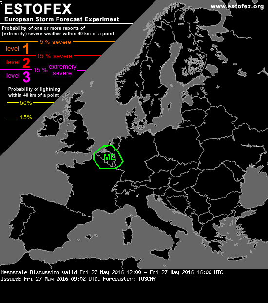
Mesoscale Discussion
Valid: Fri 27 May 2016 12:00 to Fri 27 May 2016 16:00 UTC
Issued: Fri 27 May 2016 09:02
Forecaster: TUSCHY
This mesoscale discussion was issued to reflect a level-1 upgrade over Belgium/NE France.
A short wave strained Belgium and W-Germany in time with clearing now evident in its wake. Despite weak subsidence forecast by global models, confidence in scattered CI increased with expected diabatic heating. Some weakening of the 600-500 hPa lapse rates is forecast, which precludes bigger mid-layer CAPE profiles. Nevertheless, up to 800 J/kg MLCAPE and 15 m/s DLS support a few large hail events. Heavy rain is possible with slow moving thunderstorms, which cluster betimes. The severe risk diminishes beyond sunset although thunderstorms continue well into the night and may spread all the way to the Netherlands.
The time frame for this MD will cover the period with the highest severe risk.