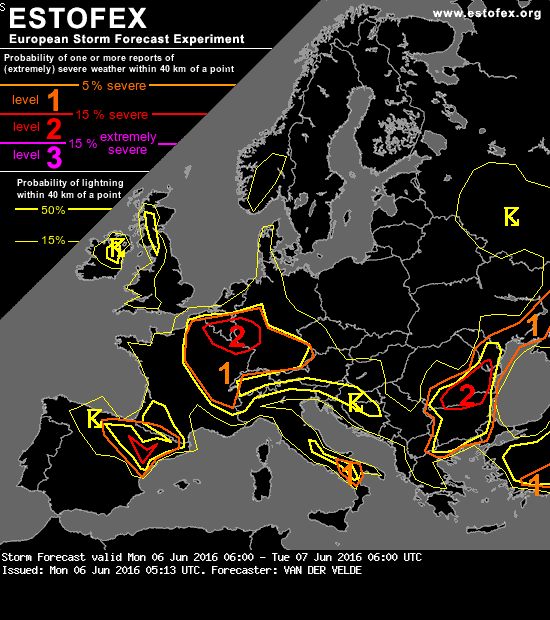
...Germany, France, Belgium, SE Netherlands area...
The main threat with slow, weakly sheared (<5 m/s 0-6 km) storms is local excessive precipitation, especially where cloud bases are lower i.e. in France, while isolated severe wind gusts and large hail are also likely in the region given the moderate MLCAPE and drier mid level air with stronger lapse rates, expressed as delta-Theta-E > 15K as well as somewhat higher cloud bases (LCL >1200m) from Netherlands to Austria.
CIN is quite weak and most storms would form in convergence lines like GFS 18Z predicts over W Germany. A level 2 was drawn for >15% combined chances of severe wind / hail / rain events where GFS optimizes CAPE, convergence, lapse rates and a PV band.
The main threat with slow, weakly sheared (<5 m/s 0-6 km) storms is local excessive precipitation, especially where cloud bases are lower i.e. in France, while isolated severe wind gusts and large hail are also likely in the region given the moderate MLCAPE and drier mid level air with stronger lapse rates, expressed as delta-Theta-E > 15K as well as somewhat higher cloud bases (LCL >1200m) from Netherlands to Austria.
CIN is quite weak and most storms would form in convergence lines like GFS 18Z predicts over W Germany. A level 2 was drawn for >15% combined chances of severe wind / hail / rain events where GFS optimizes CAPE, convergence, lapse rates and a PV band.
Was sein muss, muss sein.
 nog net in de level-2!