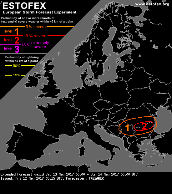
Volgens de extended forecast van estofex kan het hier goed los gaan
Bericht van: Danny (Veliko Tarnovo, Bulgarije) , 12-05-2017 08:54Severe thunderstorms with a potential of producing large to very large hail, severe wind gusts and excessive precipitation may develop in the high shear / high instability environment around afternoon hours on the border of Romania and Bulgaria.
Thanks to the position of the jet, around 25 m/s 0-6km shear will be available in this area, giving an impressive value of 1600-1800 m2/s2 WMAXSHEAR. Such values suggest that any thunderstorm developing in this environment, may have the potential of becoming severe to extremely severe and produce all kinds of thunderstorm phenomena.
The main risk justifying level 2 is associated with favourable conditions for large to very large hail. Given strong instability, steep lapse rates and strong shear, supercell thunderstorms may be capable of producing 5cm hail. Local event with hailstones reaching 6-7cm also cannot be ruled out given a good configuration of instability and shear. Strong shear in 0-3km layer as well as high instability involves also severe wind threat (especially if the squall line will evolve). Excessive precipitation and local flash flooding is also possible given PW ~ 30-35mm.