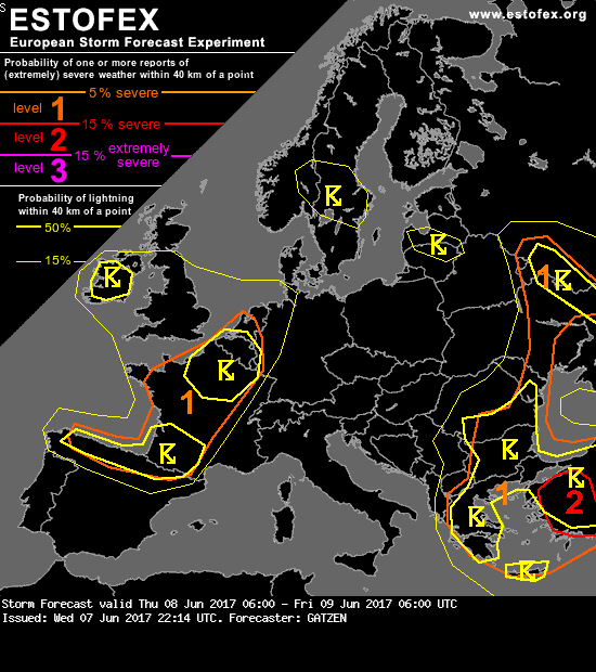
Estofex komt met een level 1, m.u.v. het noordoosten van NL
Bericht van: Anthony [Tilburg] , 08-06-2017 00:22
Northern Spain to France, Benelux countries
Ahead of the approaching upper-level trough, quite strong warm air advection is expected, and large-scale ascent can be suggested. Given strong south-westerly upper-level winds, moderate to strong deep-layer vertical wind shear will evolve. An elevated mixed-layer advects north-east and will provide steep lapse rates. Main uncertainty is low-level moisture so that initiation of storms is somewhat questionable. However, models indicate increasing moisture during the day and CAPE could develop.
Capping inversion is expected to weaken due to lift ahead of the approaching trough and associated cold front. Current thinking is that a couple of isolated storms form that evolve into supercells given favorable vertical wind shear. Large or very large hail is possible with these storms. Quite large cold pool potential can result in outflow dominant storms that form clusters capable of producing severe wind gusts while spreading north-east into northern France and Benelux ahead and along the cold front.