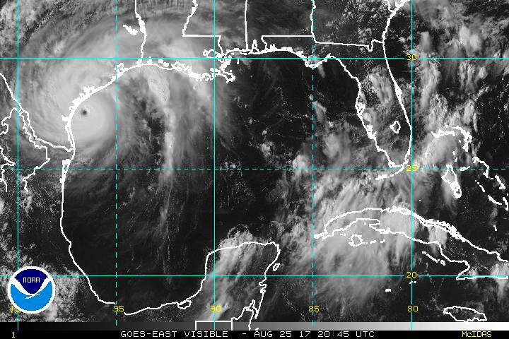
Despite its concentric eyewall structure, Harvey's winds have
increased during the day.  NOAA and Air Force Reserve Hurricane
Hunter planes have measured maximum flight-level winds of 129 kt
and SFMR winds to 102 kt.  Based on these data, Harvey's maximum
surface winds are estimated to be 110 kt.  Harvey's central pressure
has also continued to fall, and the latest estimate based on
dropsonde data is 941 mb.
Harvey may continue to strengthen during the 6-12 hours it has
before landfall, but regardless it is expected to make landfall at
major hurricane strength.  Gradual weakening is anticipated after
the center moves inland, but Harvey's slow motion will keep a
significant portion of its circulation over water, which may slow
the weakening rate.  As a result, the NHC intensity forecast leans
closer to the global model guidance instead of the statistical-
dynamical guidance, which seems to weaken Harvey too fast.  Harvey
could maintain tropical storm strength for the entire 5-day
forecast period due to its proximity to the northwestern Gulf of
Mexico.
Harvey livestream
Bericht laatst bijgewerkt: 26-08-2017 00:01
Overijssel | Beruchte dorpsgek die in de wintermaanden naar lantaarnpalen zit te staren ...