Estofex komt met Level 2 tot woensdagmorgen 07.00 uur (zal wellicht nog verlengd worden denk ik).
Tekst:
DISCUSSION
A long-wave trough will cross Europe during Tuesday, bringing cold air masses from the north. The jet stream is curved at the leading edge of the trough and a strong jet streak is expected to influence the UK, and West Europe in general, at the early morning of Wednesday. At the surface, several low-pressure centers are located over Scandinavia and two more are about to form, one over Italy with an eastbound movement to Greece and the other one over Scotland moving towards Denmark by Wednesday which will result in a very strong pressure gradient, especially in the English Channel.
.... West Europe ....
Moist air masses will be advected from the Atlantic towards France and Benelux where non-convective severe wind gusts will be the main threat. NWP models forecast steep lapse rates below this jet streak where CAPE will be about 200-300 J/kg, so scattered thunderstorms may form especially near the coasts. These storms will be able to produce severe wind gusts at the surface in the range of 25-35 m/s but limited lightning activity near the cold front. A level 2 was issued for the English Channel, France and Benelux to address the severity of the wind gusts. Non-convective severe wind gusts may as well verify in areas S-SE of the level 1 area drawn.
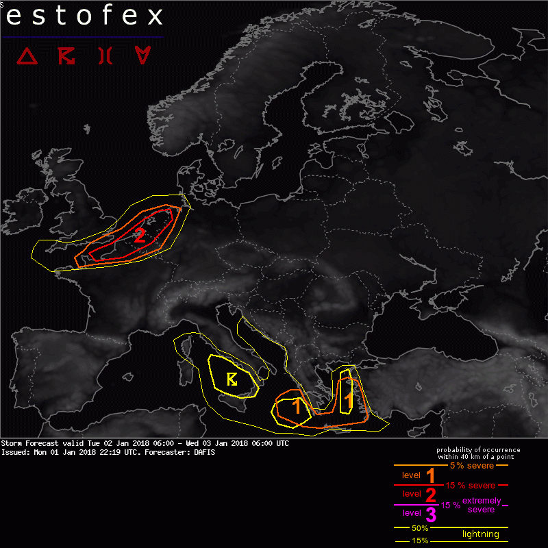
Bron: www.estofex.org