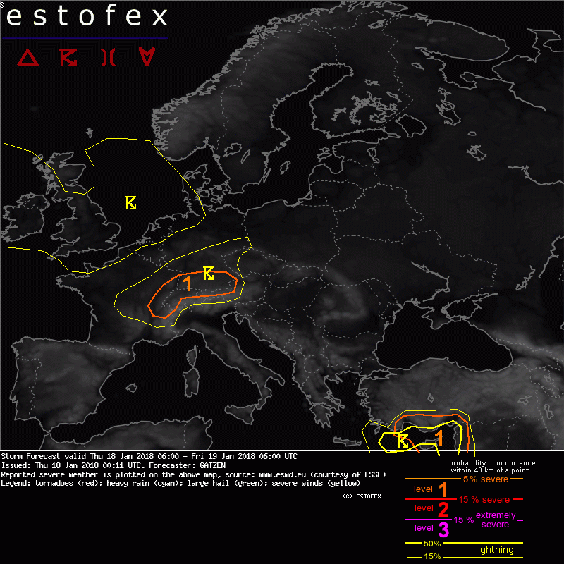
Over southern Germany, eastern France and over the northern Alpine region, a narrow cold-frontal rain band is forecast as the cold front develops in the afternoon, then with better low-level convergence. Latest GFS even indicates strong lapse rate increase in the evening hours when a strong low-level jet is pushed along the Alpine rim and is affected by the tropopause fold. As a consequence, thunderstorms that move rapidly east can be embedded in the rain band, capable of producing severe wind gusts and marginal hail. Low-level shear is strong (0-1 km shear 30 m/s, SRH 500 m²/s²), and mesovortices could form if storms produce a cold pool. In that case, tornadoes and extreme gusts are not ruled out.
Bericht laatst bijgewerkt: 18-01-2018 09:46
Was sein muss, muss sein.