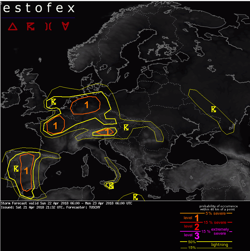
Bron: www.estofex.org
"Leading/dissolving short-wave crosses Benelux/N-Germany during the day. Temporarily cooling mid-levels atop moderate BL moisture (Tds around 10C and recovering 0-1km mixing ratios of 8-9 g/kg) support thinning tongue of somewhat steeper mid-level lapse rates. Forcing emerges from that wave but also from an organizing warm front, which should run from the North Sea to Saxony around noon and moves E/NE thereafter. CAMs agree in active CI especially over NW-Germany as warm sector should stay avoid of thick clouds (despite debris cirrus from overnight convection)- either forced by the wave or the orography towards CNTRL-Germany. 15-20 m/s DLS with rather straight hodographs support splitting and rapidly clustering multicells with large hail and heavy rain - temporal updraft rotation in initially discrete storms is possible. Forecast soundings reveal inverted-V structure in the lower troposphere and hence the risk of conglomerating cold pools with cold pool driven/bowing lines of DMC and a temporal/regional risk of strong to severe wind gusts exists. However, weak low-tropospheric background flow should keep this risk in check. The activity weakens after sunset over NE/E-Germany."
