Dit laat maar eens zien hoe groot de onzekerheid voor Leslie is. Bij de 06z run van GFS al over 48 uur aan op Portugal als een cat 1/tropische storm met 983 hPa. Het verschil met de Nhc verwachting is enorm. Bij Nhc krult Leslie naar beneden en komt ze niet eens in de buurt van Portugal. Ik kan me niet de laatste keer herinneren dat er zoveel onzekerheid was over de richting van een orkaan over een periode van slechts 48 uur.
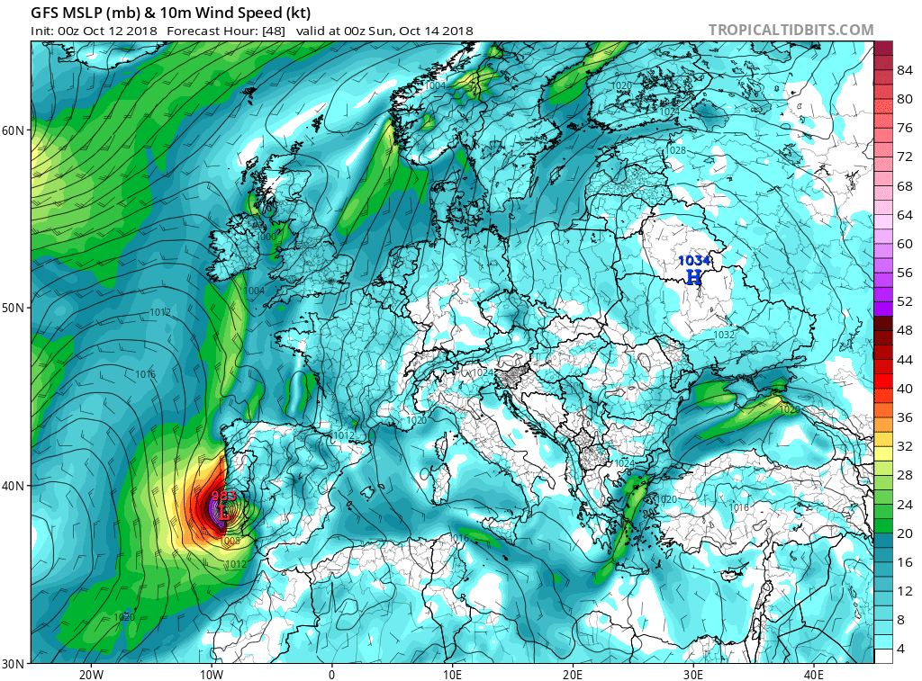

Blijkbaar is de NHC forecast niet wezenlijk veranderd tov gisteren (wel iets oostelijker, maar nog steeds die bocht). Dat brengt de Canarische eilanden nadrukklijker in de gevarenzone. Dit zegt het NHC erover:
Leslie continues to accelerate east-northeastward with an initial
motion estimate of 070/23 kt.  The hurricane should move rapidly
in that general direction for the next day or so ahead of a
mid-latitude trough, then bend eastward and southward as the main
steering mechanism switches to the eastern Atlantic subtropical
ridge.  There is still a large guidance spread, over 700 miles at
day 3, but the main change to report is that more of the models are
continuing the east-northeastward track longer, possibly due to
Leslie becoming a stronger system.  The official forecast is
shifted to the east, but is still well to the southwest of the
model consensus, ironically similar to last night's forecast.

Leslie is a fairly large tropical cyclone and the forecast wind
radii encompass Madeira Island within 36 hours.  Consequently, a
tropical storm warning has been issued for that island.  It is the
first known tropical storm warning for that place, and there are
no known tropical storms in the historical record anywhere
within 100 miles of that island, with the closest being Vince of
2005.