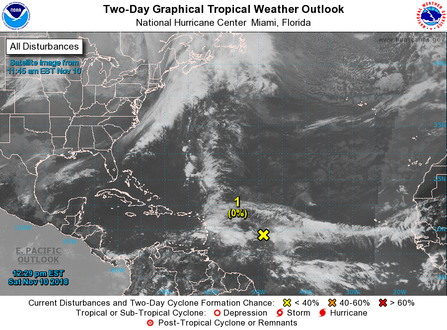
Reis gaat van Martinique via Mindelo Cabo Verde en dan verder noord richting Algeciras.Komende dagen wordt weinig activering verwacht, maar het is nu al bijzonder matig. Zware geclusterde buien en regengebieden. Wind strak ozo 5 - 6 bft, confused swell zo-no 2 - 3 meter.
ZCZC MIATWOAT ALL
TTAA00 KNHC DDHHMM

Tropical Weather Outlook
NWS National Hurricane Center Miami FL
100 PM EST Sat Nov 10 2018

For the North Atlantic...Caribbean Sea and the Gulf of Mexico:

1. A tropical wave located about 700 miles east of the Lesser Antilles
continues to produce disorganized showers and thunderstorms.
Significant development of this system is not expected during the
next couple of days due to strong upper-level winds. However, these
winds are forecast to lessen by Tuesday, and a tropical or
subtropical cyclone could form during the middle of next week while
the system moves near or north of Puerto Rico, Hispaniola and the
southeastern Bahamas.
* Formation chance through 48 hours...low...near 0 percent.
* Formation chance through 5 days...medium...40 percent.

Forecaster Blake