Michael Ventrice tweet: MJO en de gevolgen over 3-6 weken: N-blokkades
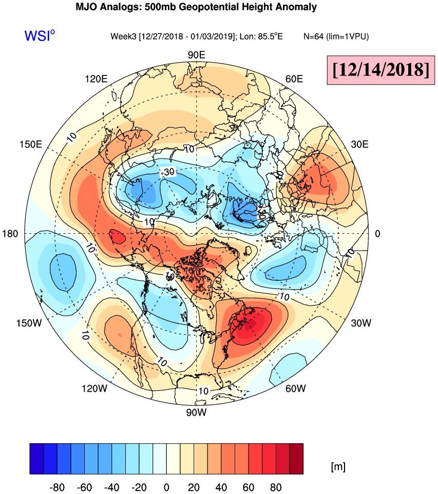
Bericht van: sebastiaan (bussum) , 14-12-2018 14:07A statistical model that I've developed using the observed state and amplitude of the MJO shows an evolution towards high latitude blocking from the North Pacific through the North Atlantic in 4-6 wks. Sets up a cold pattern for N America and Europe. We'll see how this plays out. http://twitter.com/MJVentrice/status/1073547162980638722
Maar...
Only 64 dates found in this analog set. You have to worry about sample size in these composites though it does signify the current MJO event over the Indian, as identified by MJO filtered VP200, is highly anomalous.
Ik kan geen tweet embedden, dus je 'moet' maar even klikken op de link. De compositie laat in ieder geval week 3-6 sterke hogedruk zien bij Groenland.
Zwarte, dreigende wolken worden soms uit alle hemelstreken nog door den dampkring, die ons omringt, heen gejaagd en ontbinden zich dan niet zelden in koude, somtijds met sneeuwvlokken vermengde regendroppelen of kletterenden hagel, die de ontspruitende grashalmen en de teedere bloemen, welke reeds de lagchende knopjes in den koesterenden zonneschijn ontsloten, met verwoesting dreigen; maar geen nood! achter die donkere wolken is de Lente geboren. Petronella Moens.
