Boeiende tweets Michael Ventrice (edit, vertaald)
Bericht van: sebastiaan (bussum) , 21-12-2018 10:51http://twitter.com/MJVentrice/status/1075897160737189888
Een van mijn favoriete Twitteraars is Michael Ventrice. Dat mag ondertussen wel duidelijk zijn. De reden is tweevoudig. Dr. in de meteorologie, dus hij weet waar hij over praat en hij legt uit en deelt veel.
Edit. Ik heb het vertaald.
If you were to identify El Nino atmospheric base states through Low pass filtered 200mb velocity potential anomalies, you would find the strongest El Ninos are associated with a monster Aleutian Cyclone and ridge over North America. But if you reduce the amplitude, the -NAO pops.
Er is een belangrijk onderscheid in verschillende El Nino's. Bij Sterke El Nino's zoals we vrij recent hadden zien we een zeer sterk lagedrukgebied bij de Aleoeten en een rug over N-A. Maar als de El Nino minder heftig is zie je dat een negatieve NAO plaatsvindt.
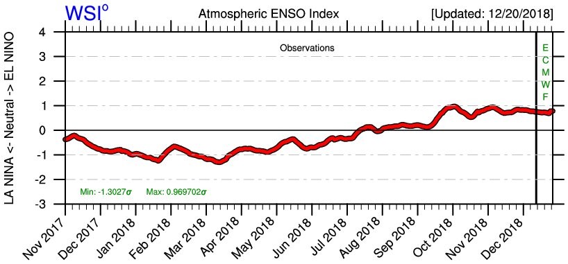
According to my Atmospheric ENSO Index, the atmosphere is not in a strong El Nino state, but aligns more with a "weak" El Nino state.
De atmosfeer laat de gevolgen van een zwakke El Nino zien.
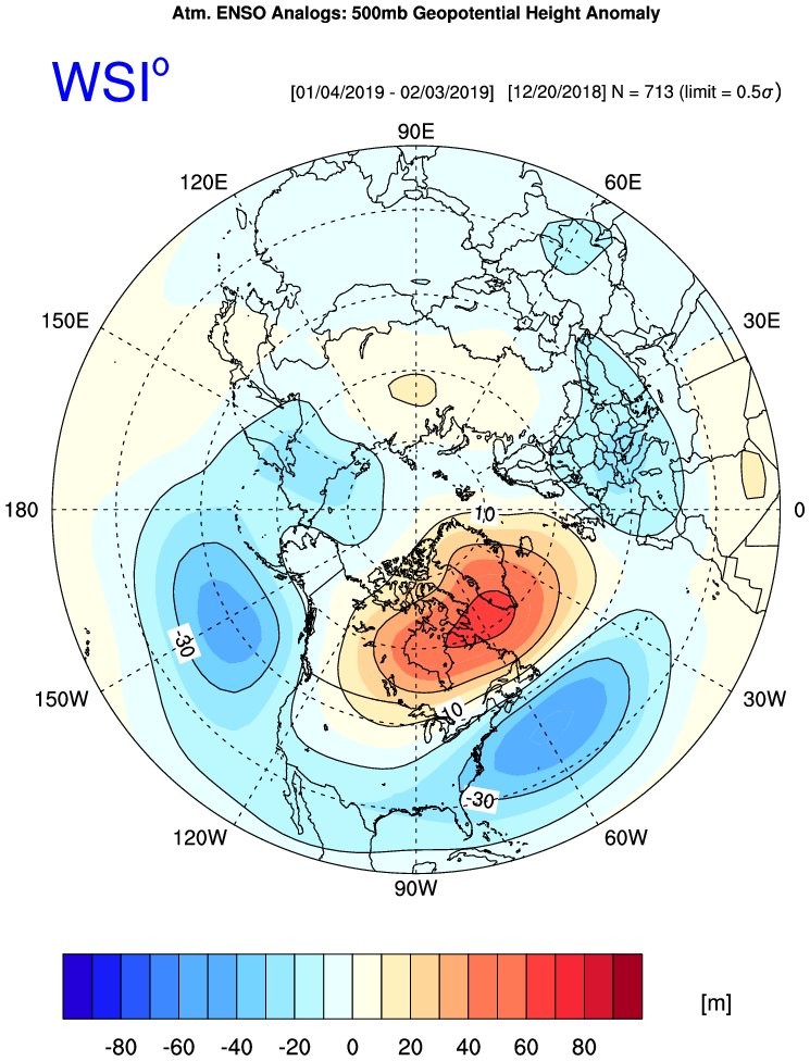
By taking the current AEI value and add a threshold (+/-0.5 sigma)... for example if AEI = 1sigma, your range would be +0.5 and +1.5 sigma... and include the time of year into the equation, you'd find a 500mb geopotential height anomaly composite that favors -NAO in Jan+Feb.
Hij laat zien hoe hij tot onderstaande kaart komt. Het is gebaseerd op tijd van het jaar en 500 hPa compositie. Dus wat gebeurde er in een vergelijkbare setting in het verleden?
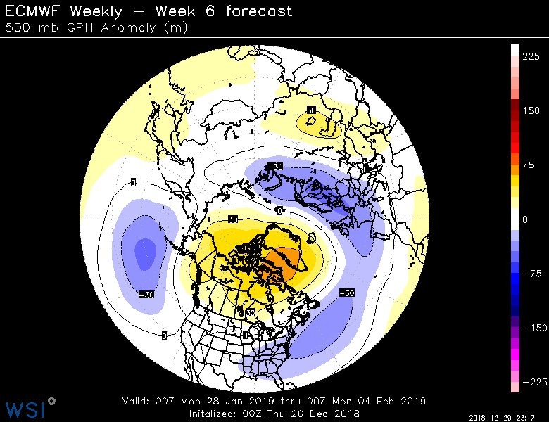
Take a look at the ECMWF Week 6 fcst for late Jan. Perhaps the model is "feeling the weak El Nino", but we all know there's a sudden stratospheric warming event at hand.. which leads to -NAO development. Do these "Weak El Nino" states favor SSWEs? Does the SSWE even matter?
EC week 6 laat een negatieve NAO zien. Maakt de SSW eigenlijk wel uit?