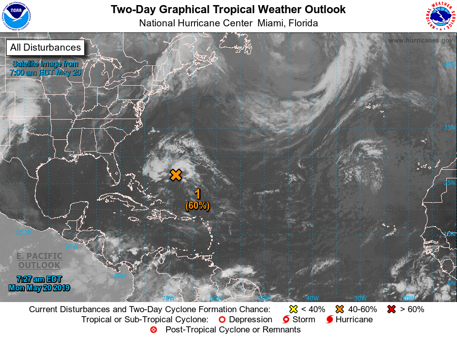
Mogelijk eerste orkaan deze week op de Atlantische Oceaan volgens NHC
Bericht van: Marcel (Den Haag) , 20-05-2019 16:46Nog 10 dagen en het seizoen is officieel begonnen.
For the North Atlantic...Caribbean Sea and the Gulf of Mexico:
1. Showers and thunderstorms have increased overnight and this morning
in association with a trough of low pressure located about midway
between the Bahamas and Bermuda. A low pressure system is expected
to form within this area of disturbed weather later today, and this
system could become a short-lived subtropical or tropical cyclone by
tonight or Tuesday while it moves northward or northeastward. By
Wednesday, however, conditions are forecast to become unfavorable
for further development, and the system should be absorbed by a cold
front. An Air Force Reserve reconnaissance aircraft is scheduled to
investigate the disturbance this afternoon, if necessary. Interests
in Bermuda should monitor the progress of this system. The next
Special Tropical Weather Outlook will be issued by 2 PM EDT today.
* Formation chance through 48 hours...medium...60 percent.
* Formation chance through 5 days...medium...60 percent.