https://wp.worldclimateservice.com/home/2019/08/16/autumn-mslp-forecasts-from-copernicus/
It’s also remarkable to see that all but one of the models has negative skill over Iceland, and only the Météo-France model shows positive skill across most of the North Atlantic domain. Based on this metric, the Météo-France model appears to be the best-performing model for autumn MSLP in the areas that are most significant for the NAO phase.
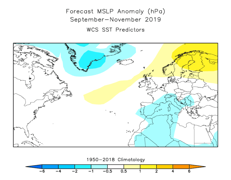
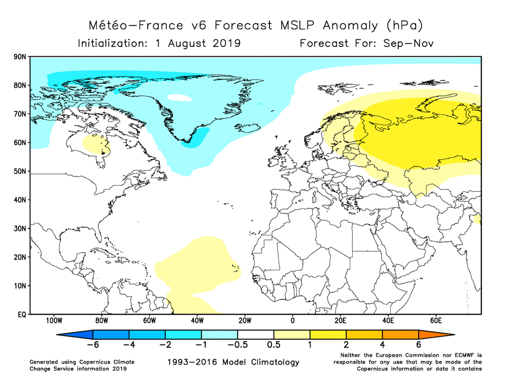
So what does the Météo-France model expect for this autumn? The map below shows that it clearly supports the idea of a trough over Greenland, and this suggests that we perhaps should give some credence to the idea of a positive NAO phase returning. Interestingly the model also shows a rather strong indication of high pressure over northern Eurasia, and while this area does not show skill in the Météo-France hindcasts, it is worth noting that a ridge over Scandinavia is also indicated by a World Climate Service statistical model based on recent sea surface temperatures (see the second figure below). The correspondence between the two completely independent MSLP forecasts is quite striking and certainly adds some confidence to the seasonal outlook.
Commentaar van WCS over de NAO komende herfst. Positieve NAO en hogedruk in het N van Europa.