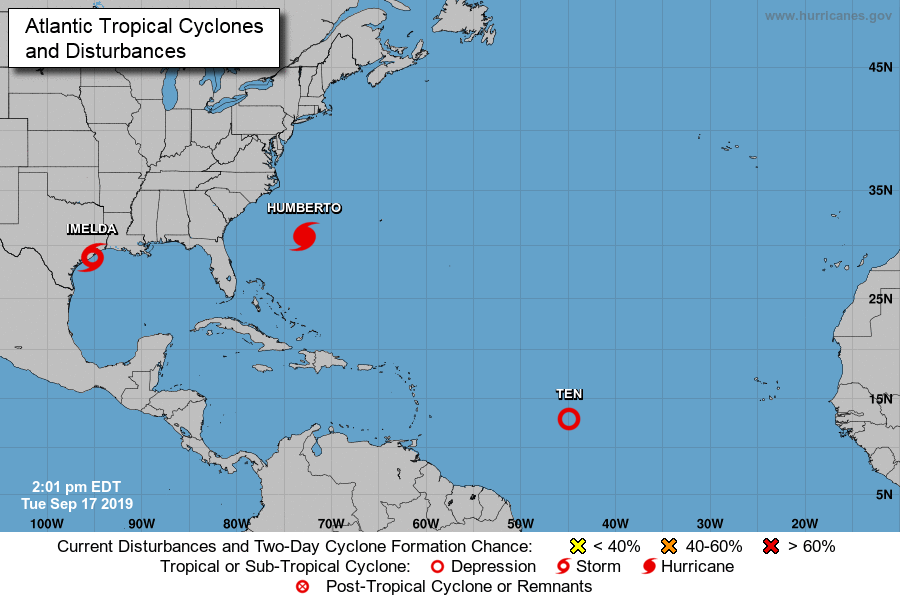
Al dagen een chaotisch plukje onweersbuien met vanochtend nog slechts 10% kans op ontwikkeling, een paar uur geleden toch de waarneming van een tropische depressie. Net is deze zelfs opgewaardeerd naar tropische storm Imelda. Lang heeft de storm niet om aan te sterken, ze zal snel aan land gaan met vooral veel regen en overstromingsgevaar in de laagliggende kustgebieden.
Ook op de Oceaan inmiddels depressie nummer 10. Deze gaat aansterken tot een orkaan en richting het westnoordwesten is de verwachting.
...DEPRESSION BECOMES TROPICAL STORM IMELDA...

Surface observations indicate that the depression has strengthened
as it nears the coast and has become Tropical Storm Imelda, with
maximum sustained winds near 40 mph (65 km/h). A National Ocean
Service observing site at Freeport, Texas, recently reported a
sustained wind of 40 mph (65 km/h) and a wind gust of 47 mph (76
km/h).


SUMMARY OF 1245 PM CDT...1745 UTC...INFORMATION
---------------------------------------------------
LOCATION...28.9N 95.3W
ABOUT 0 MI...0 KM S OF FREEPORT TEXAS
ABOUT 40 MI...65 KM SW OF GALVESTON TEXAS
MAXIMUM SUSTAINED WINDS...40 MPH...65 KM/H
PRESENT MOVEMENT...N OR 5 DEGREES AT 7 MPH...11 KM/H
MINIMUM CENTRAL PRESSURE...1009 MB...29.80 INCHES

$$
Forecaster Brennan/Brown
Bericht laatst bijgewerkt: 17-09-2019 20:13