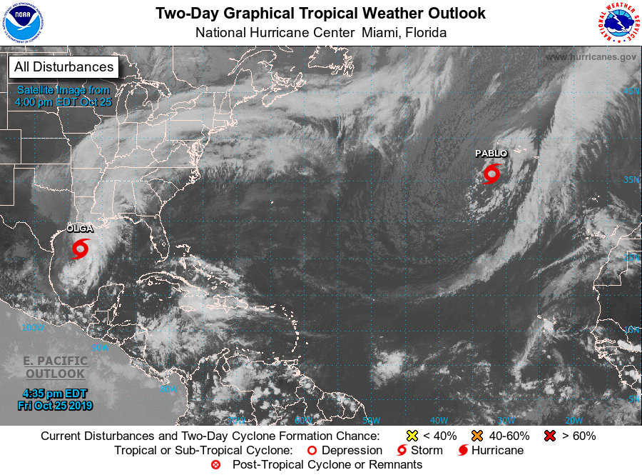
Olga in de golf van Mexico haalt de Amerikaanse kust waarschijnlijk niet omdat 'ze' voor die tijd uit elkaar valt.
Pablo trekt mogelijk over de oostelijke Azoren. Deze zagen de meteorologen van het NHC niet aankomen: 
000
WTNT43 KNHC 252036
TCDAT3

Tropical Storm Pablo Discussion Number   1
NWS National Hurricane Center Miami FL       AL182019
500 PM AST Fri Oct 25 2019

High-resolution visible satellite imagery gave us a surprise today.
A tropical cyclone has formed within a larger extratropical cyclone
in the northeastern Atlantic. This is not unique and has occurred
several times in the past, primarily during the latter part of the
hurricane season. Pablo is a very small-scale tropical cyclone, but
ASCAT data clearly show a well-defined but small circulation with
40-kt winds embedded within the larger low. This is the intensity
assigned to the cyclone for this advisory. The cloud pattern
consists of an eye-type feature surrounded by a ring of deep
convection. Given the small size of the cyclone, and the baroclinic
environment, the intensity forecast is highly uncertain. At this
time, the NHC forecast calls for a small increase in the winds and
for the cyclone to become extratropical in about 36 hours. However,
this transition could occur sooner than anticipated.