A HAZY SUNRISE TO WELCOME IN 2020
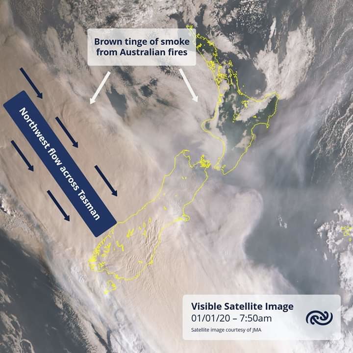
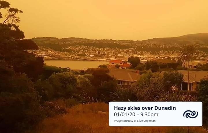
An continuous northwest flow from eastern Australia across the Tasman Sea has meant the lower two thirds of the country have woke up to hazy conditions as bush fire smoke affects the area. Some in the lower South Island may also see a brown or orange tinge in the air from the smoke itself and also from the fact the smoke particles act to scatter the 'blue end' of the visible light spectrum away from eyes on the ground (this effect will be more apparent during sunrise and sunset when the sun's rays have to travel through a larger 'slab' of the troposphere and therefore smoke particles).
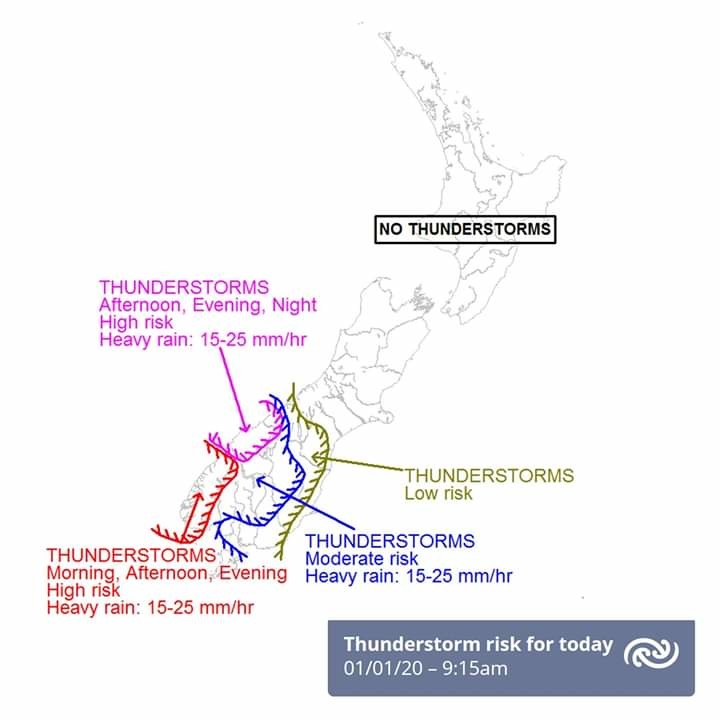
Smoke haze is expected to ease over the lower South Island later today as a front and southwest change moves over. This front is forecast to bring some rain and a high potential for localised thunderstorms, especially for Fiordland and the lower West Coast. For the latest thunderstorm risk charts (out to 48 hours) see http://bit.ly/TSOutlook.
This front is set to move north to sit over central NZ by midnight Thursday, bringing cooler and 'fresher' air in from the southwest. For more details on the weather in your backyard or camping spot in the next couple days head to metservice.com ^AC