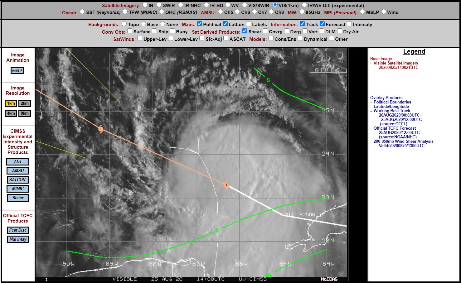
Na het passeren van Cuba, wat het aansterken nog even beperkte zijn nu alle ingredienten er om aan te sterken tot een major hurricane.
De verwachte landfall is nu op de grens Texas-Louisiana, maar dat kan nog wel wat veranderen op deze termijn.
Hier gaan we vast in het nieuws nog veel van horen (en zien).
849
WTNT43 KNHC 251505
TCDAT3

Hurricane Laura Discussion Number  23
NWS National Hurricane Center Miami FL       AL132020
1000 AM CDT Tue Aug 25 2020

Satellite imagery shows that Laura has become a little better
organized since it crossed western Cuba, and it now has a central
dense overcast and some outer banding in the southern quadrant.
Reports from Air Force Reserve and NOAA Hurricane Hunter aircraft
included SFMR winds of near 65 kt, 700-mb flight-level winds as high
as 77 kt, and a central pressure near 990 mb.  Based on these data,
Laura has been upgraded to a hurricane with an initial intensity of
65 kt.

The initial motion is west-northwestward or 290/14 kt.  The
hurricane is currently on the south side of a large-deep layer ridge
over the southeastern United States, and it is moving toward a break
in the ridge caused by mid- to -upper-level troughing over Texas and
the southern Great Plains.  The current and forecast synoptic
pattern should steer Laura west-northwestward today followed by a
turn toward the northwest tonight and toward the north by Wednesday
night and Thursday.  This will result in the hurricane making
landfall in the area of southwestern Louisiana or the upper Texas
coast late Wednesday night or Thursday morning.  The new forecast
track before landfall has been nudged a little to the west of the
previous track in response to a westward nudge in the guidance.
However, it still lies a little east of the consensus models at the
time of landfall.  After landfall, Laura is expected to recurve into
the westerlies and move eastward through the Tennessee Valley and
the mid-Atlantic States.

The hurricane currently looks a little ragged, with little or no
convection outside of the central dense overcast and the southern
quadrant banding.  This may be due to dry air in the vicinity and
some light northerly shear.  Conditions appear generally favorable
for strengthening during the next 36 h, and the new intensity
forecast calls for Laura to become a major hurricane during this
time.  The global model are in good agreement that the hurricane
should encounter increasing shear in the last 12 h before landfall,
although the potential impacts on the landfall intensity are
unclear.  After landfall, Laura should weaken through the 96 h
point.  After that, some re-intensification is expected as the
storm becomes extratropical.