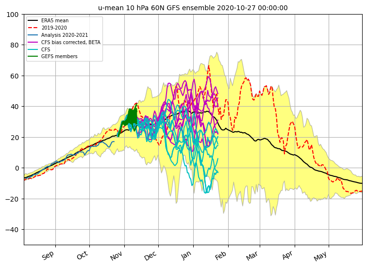
Zie de onderstaande afbeelding.
Cohen spreekt erover in zijn blog https://www.aer.com/science-research/climate-weather/arctic-oscillation/
Speaking of the PV, it is looking very healthy over the next two weeks. It is predicted to be centered near the North Pole with lowering geopotential heights and mostly zonal or straight west to east flow counterclockwise around the center of low pressure (Figure iv). There is the risk that the strong PV couples with the troposphere all the way to the surface (as happened for much of last winter) in the coming weeks, resulting in an overall mild pattern across the mid-latitudes of the NH. That the stratospheric PV is relatively strong in the fall is not that unusual in recent years but if the cold/negative stratospheric polar cap geopotential height anomalies (PCHs) couple with the troposphere, cold/negative PCHs in the troposphere is unusual in the fall. It last happened in 2015 and before that 2013 but especially 2011. Comparisons to 2011 seem to keep coming up and if it snows the end of the month here in Southern New England, that will be yet another eerie similarity to 2011. There was no significant weakening of the PV that winter and North America was very mild that winter, though Eurasia experienced widespread below normal temperatures. Though to be clear I am not expecting a repeat of the 2011/12 winter, at least not yet.