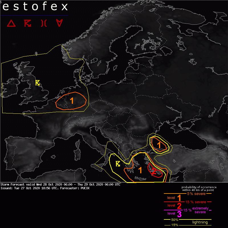
Zoals gisteren hier al werd aangegeven vandaag dus een boeiende dag met mogelijk een aantal forse buien in een dynamische setting. Estofex komt met een level 1 voor het zuidoostelijke deel van de BeNeLux. Een aantal interessante elementen zijn te vinden in de bijgevoegde text. Iemand een update met de laatste stand van zaken w.b. de parameters?
DISCUSSION
... BENELUX and Germany ...
A low-end threat of severe wind gusts and tornadoes will develop over the area in the overnight hours in conjunction with the approach of fast-moving short-wave. Forecast soundings reveal marginal latent instability with rather warm EL (=10 till -20 deg C). Isolated to scattered low-topped storms are forecast to develop and will likely attain nature of fast-moving line segments or supercells given 0-3 km bulk shear over 15 m/s. 850 hPa flow in between of 20 and 25 m/s suggests potential for isolated severe wind gusts in stronger downdrafts. Supercells will also bear a risk of tornadoes with low LCLs and 0-1 km bulk shear between 10 - 15 m/s.