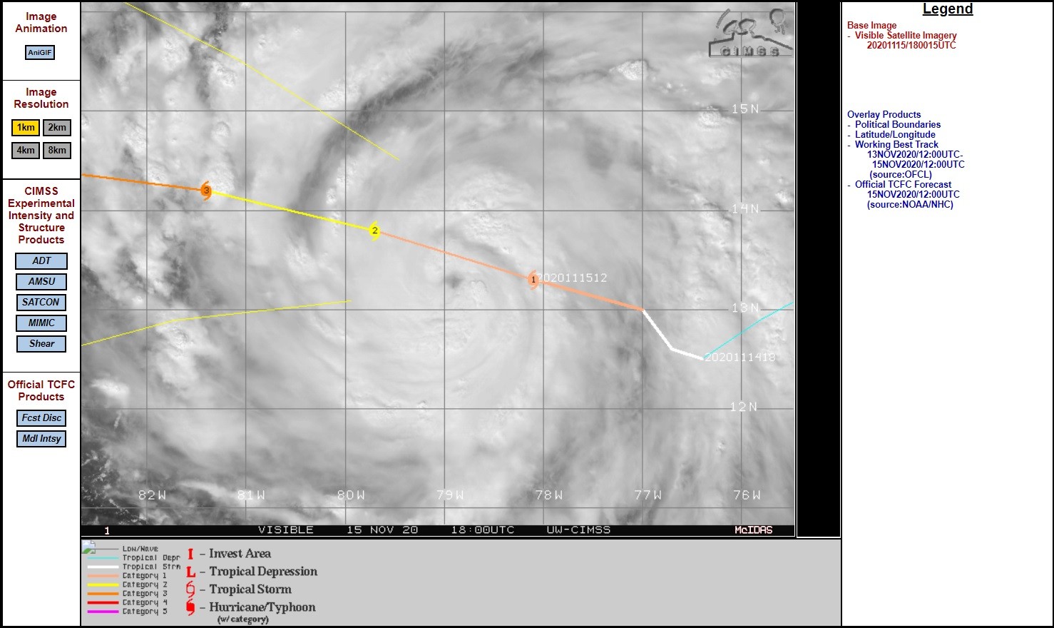
Nu nog officieel 150 kmh gemiddeld, maar de hurricane hunters zullen straks wel met hogere waarden komen. Bij landfall wordt een windsnelheid van 220 kmh verwacht (cat 4)
000
WTNT31 KNHC 151748
TCPAT1

BULLETIN
Hurricane Iota Intermediate Advisory Number 9A
NWS National Hurricane Center Miami FL       AL312020
100 PM EST Sun Nov 15 2020

...AIR FORCE HURRICANE HUNTER AIRCRAFT CURRENTLY INVESTIGATING
IOTA...
...THE HURRICANE IS EXPECTED TO BRING POTENTIALLY CATASTROPHIC
WINDS, A LIFE-THREATENING STORM SURGE, AND EXTREME RAINFALL IMPACTS
TO CENTRAL AMERICA...


SUMMARY OF 100 PM EST...1800 UTC...INFORMATION
----------------------------------------------
LOCATION...13.1N 78.9W
ABOUT 170 MI...275 KM E OF ISLA DE PROVIDENCIA COLOMBIA
ABOUT 315 MI...520 KM ESE OF CABO GRACIAS A DIOS ON NIC/HON BORDER
MAXIMUM SUSTAINED WINDS...90 MPH...150 KM/H
PRESENT MOVEMENT...W OR 280 DEGREES AT 9 MPH...15 KM/H
MINIMUM CENTRAL PRESSURE...977 MB...28.85 INCHES


WATCHES AND WARNINGS
--------------------
CHANGES WITH THIS ADVISORY:

None.

SUMMARY OF WATCHES AND WARNINGS IN EFFECT:

A Hurricane Warning is in effect for...
* Providencia
* The coast of Nicaragua from the Honduras/Nicaragua border to
Sandy Bay Sirpi
* The coast of northeastern Honduras from Punta Patuca to the
Honduras/Nicaragua border

A Hurricane Watch is in effect for...
* San Andres

A Tropical Storm Warning is in effect for...
* San Andres
* The coast of Nicaragua from south of Sandy Bay Sirpi to Bluefields
* The northern coast of Honduras from west of Punta Patuca to Punta
Castilla

A Hurricane Warning means that hurricane conditions are expected
somewhere within the warning area.  Preparations to protect life
and property should be rushed to completion.

A Hurricane Watch means that hurricane conditions are possible
within the watch area.

A Tropical Storm Warning means that tropical storm conditions are
expected somewhere within the warning area within 36 hours.

Interests elsewhere in Nicaragua and Honduras should monitor the
progress of Iota.

For storm information specific to your area, please monitor
products issued by your national meteorological service.


DISCUSSION AND OUTLOOK
----------------------
At 100 PM EST (1800 UTC), the center of Hurricane Iota was located
near latitude 13.1 North, longitude 78.9 West. Iota is moving toward
the west near 9 mph (15 km/h). A westward to west-northwestward
motion is expected through landfall.  After landfall, a westward to
west-southwestward motion is forecast.  On the forecast track, the
core of Iota will move across the southwestern Caribbean Sea today,
pass near or over Providencia island late tonight or Monday, and
approach the coasts of northeastern Nicaragua and eastern Honduras
within the hurricane warning area late Monday.

Maximum sustained are near 90 mph (150 km/h) with higher gusts.
Rapid strengthening is expected during the next 36 hours, and Iota
is forecast to be an extremely dangerous category 4 hurricane when
it approaches Central America.

Hurricane-force winds extend outward up to 25 miles (35 km) from
the center and tropical-storm-force winds extend outward up to 115
miles (185 km).

The latest minimum central pressure reported by an Air Force
Reserve reconnaissance aircraft is 977 mb (28.85 inches).
https://www.nhc.noaa.gov/text/refresh/MIATCPAT1+shtml/151748.shtml