Uiteraard wordt hier ook veel besproken meer bij onze Britse buren wordt ook veel besproken rondom de aanstaande SSW. Hier een mooi stukje (link naar topic):
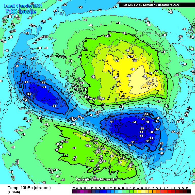
Slight nuances to the story today but still largely the same. The monster warming at the top of the stratosphere continues and if anything we see even more evidence of Wave 2 attack by the end of the 0z GFS forcing a split between 10-5mb and a complete removal of the vortex from over the pole above.
Less of a split noticeable below this (the bottom up action we spoke about yesterday will always be more prone to swings as this is troposphere dependent) however the core of the vortex in the lower stratosphere looks likely to shift to somewhere east of Greenland.
Two things to note from this. Firstly in the shorter term such a lower stratospheric pattern would suggest that a broad NW European trough is the most likely way forward in terms of long wave features - that isn’t to say there won’t be some of those pesky shortwave lows that spring up and scupper cold chances, but in general we would expect to see higher than normal heights around the mid Atlantic and any such areas of equal longitude.
Secondly, if you can remember back to some of the awesome 3D animations @Recretos has produced of the vortex in the past, you’ll hopefully be able to remember that a happy vortex = a vortex that is spinning away on a consistent axis right through the atmosphere, ideally somewhere close to the pole. Where as what we are likely to end up with over the next few weeks is a vortex whose top at 1mb is located somewhere over towards the US, whilst the bottom down towards the tropopause sits somewhere closer to Svalbard. This leaves us with a very unbalanced and drunk looking vortex (well, it is nearly Christmas I suppose) and means that we should expect less and less influence of a strong westerly vortex around the pole for the foreseeable future - in other words, we should expect extended spells of AO at least at neutral levels, if not negative.
That’s the minimum. What comes after that if the wave action at the top sinks down lower into the heart of the stratosphere in the first 3rd of Jan could pique the interest of those of a cold persuasion even further
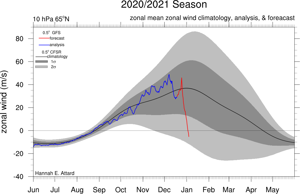
En nog een kaartje, voor het eerst negatieve zonale winden op 10hPa in de uitvoer?
En een split inmiddels in de uitvoer van GFS: