Storm Forecast
Valid: Fri 18 Jun 2021 06:00 to Sat 19 Jun 2021 06:00 UTC
Issued: Thu 17 Jun 2021 21:21
Forecaster: GROENEMEIJER
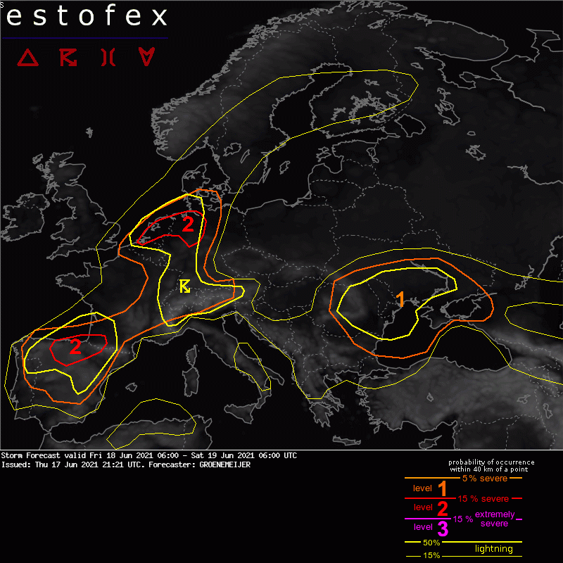
A level 2 was issued across the Netherlands and northern Germany for hail, tornadoes, wind gusts, and to a lesser extent for localized heavy rainfall.
A level 1 was issued for North Portugal, large parts of Spain, for the western and central Alpine region, for Belgium, Luxembourg, for large parts of Germany and Denmark. This level 1 one is issued for large hail and to a lesser extent for localized heavy rainfall.
DISCUSSION
Northwest Belgium, Netherlands, and far northwestern Lower Saxony
Across the Benelux, a warm front stretching northeastward from a low-pressure area initially located across Normandy is expected to lift northward during the day. Elevated convection should be ongoing on the cool side of the front and near the low's centre. Aided by quasi-geostrophic lift for upward motion and diurnal heating, scattered storms are expected to initiate over northwestern Belgium and the central to southern Netherlands in the afternoon. Deep-layer shear of around 15-20 m/s should aid updraft rotation, in particular where storms cross the warm frontal boundary, located near a line from Amsterdam to Bremen at 12 UTC. NWP models indicate MLCAPE values in the 1500-2500 J/kg range and enhanced 0-500m storm-relative helicity near this boundary, suggesting a transient risk of tornadoes with stronger cells crossing it. Any storms will have also have a risk of large hail of up to 5 cm diameter, isolated severe wind gusts, and local very heavy rainfall.
Level 1 areas of Belgium, France, Luxembourg, Germany, Western Alps...
A lower risk of storms with large hail and locally heavy rain exists across this area, the risk being lower as a result of lower instability, shear and/or storm coverage. Across Southwest Germany, scattered to widespread storm development is likely, but the severe risk lower than further north because of the comparatively weaker wind shear.