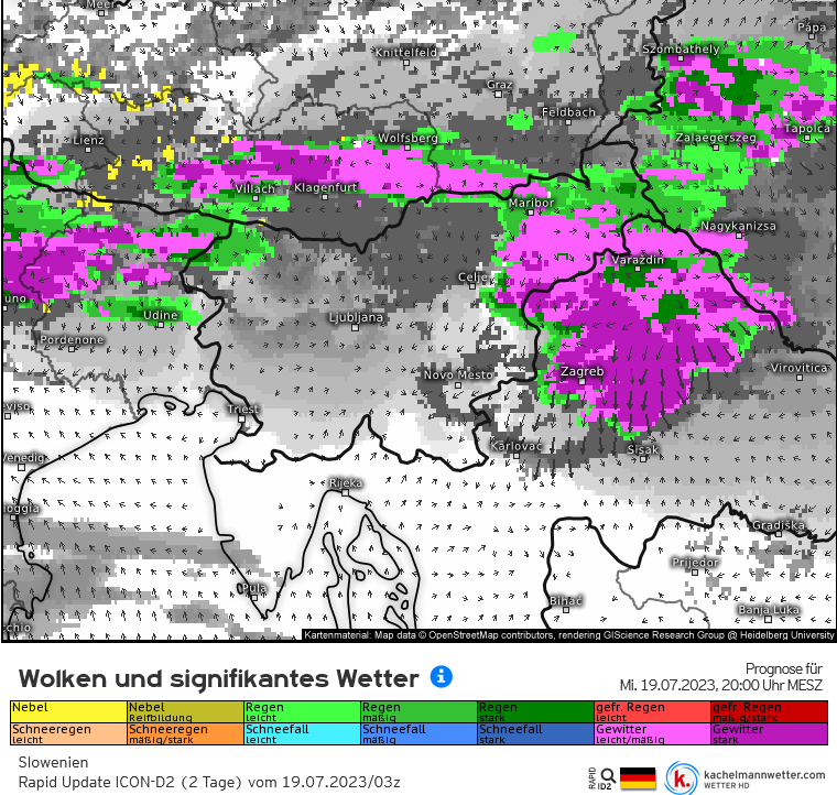
Vandaag nogmaals zwaar weer van zuid Oostenrijk naar Kroatie
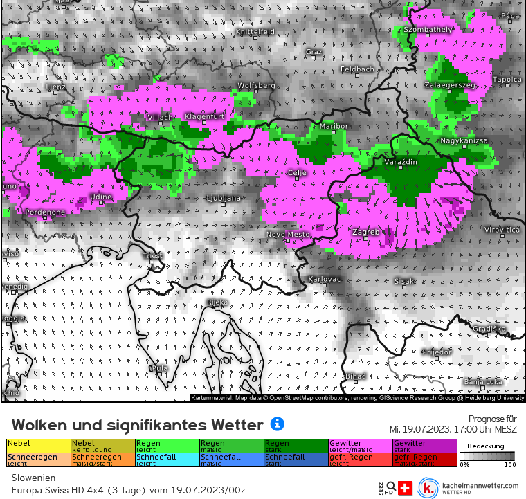
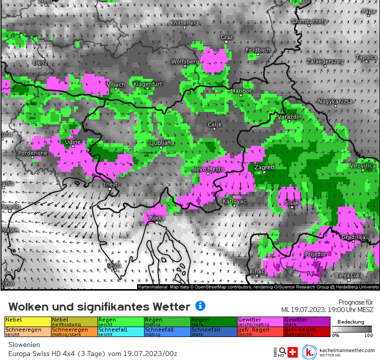
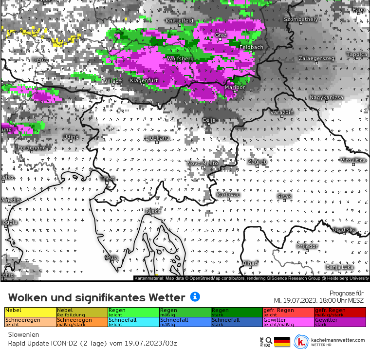
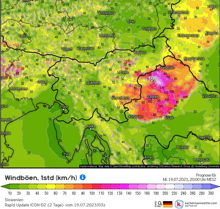
Bericht van: Peter (Wiltz -Luxemburg) , 19-07-2023 07:36Goedemorgen! Op de grens van de koelere en de zeer warme lucht komt het ook vandaag tegen de avond tot de ontwikkeling van (zeer) zware buien met windstoten tot ver boven de 100 km/u, en opnieuw hagel van meer dan 5 cm. Zowel ICON-D2 als Swiss HD geven deze ontwikkeling. De nowcast van Swiss HD geeft geen updates meer sinds de run van gisteravond 22Z.
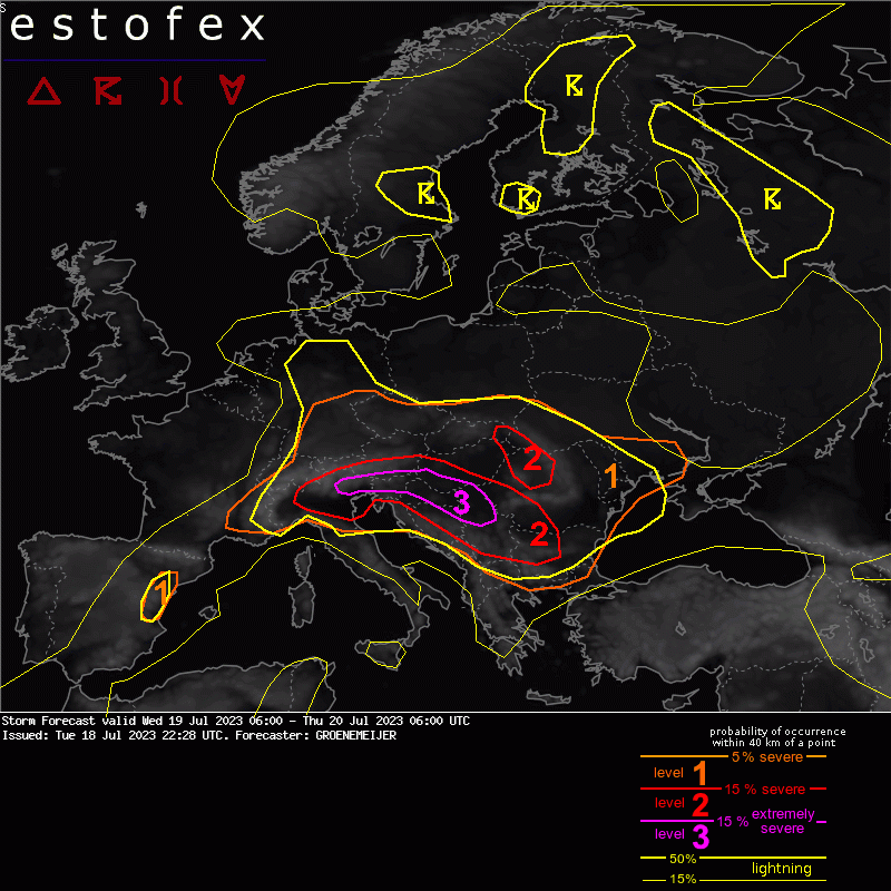
Er is nu wel een Estofex- level 3-waarschuwing uitgegeven. Het ziet er dus opnieuw zeer fors uit.
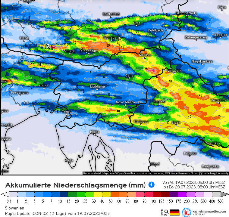
De eerste twee afbeeldingen na de kaart van Estofex zijn van Swiss-HD 00Z, de rest van ICON-D2 03Z. Die maximale windstoot van 191 km/u lijkt wat overdreven, maar een gewaarschuwd mens telt voor twee.
Storm Forecast
Valid: Wed 19 Jul 2023 06:00 to Thu 20 Jul 2023 06:00 UTC
Issued: Tue 18 Jul 2023 22:28
Forecaster: GROENEMEIJER
A level 3 was issued across parts of Italy, Austria, Slovenia, Hungary, Croatia, Bosnia and Serbia, firstly for very large hail and damaging winds, and secondly for very heavy precipitation.
SYNOPSIS
A strong zonal jet streak is located across central Europe at the northern fringe of a pronounced elevated mixed layer. The combination of the associated steep lapse rates and ample low-level humidity across Po Valley and the northwestern Balkans lead to very high MLCAPE in a zone from Serbia through the northwestern Balkans, with values of 2000-3000 J/kg, into the Po Valley, where values in the 3000-5000 J/kg range are predicted. A high-end severe weather situation with very large hail and widespread severe winds is expected to develop as a subtle upper-level vorticity maximum moves into the region, setting the stage for convective initiation of this volatile environment.