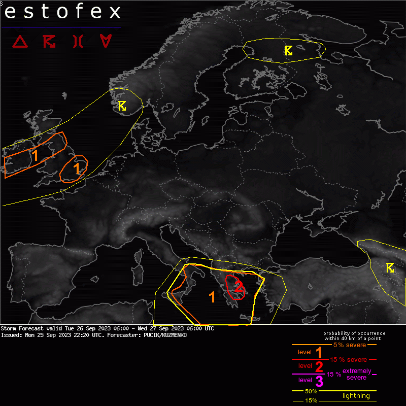
Continuous redevelopment of storms capable of very heavy rainfall is expected in the region, resulting in perhaps widespread flash flooding. Besides heavy rainfall, large hail is also forecast given large amounts of CAPE above-10 deg C isotherm. Across the eastern flank of the Lvl 2, at least some surface based CAPE will combine with strongly curved hodographs and 0-1 km SRH locally above 200 m2/s2 and low LCLs, yielding tornado threat.
Weerstation Wommelgem