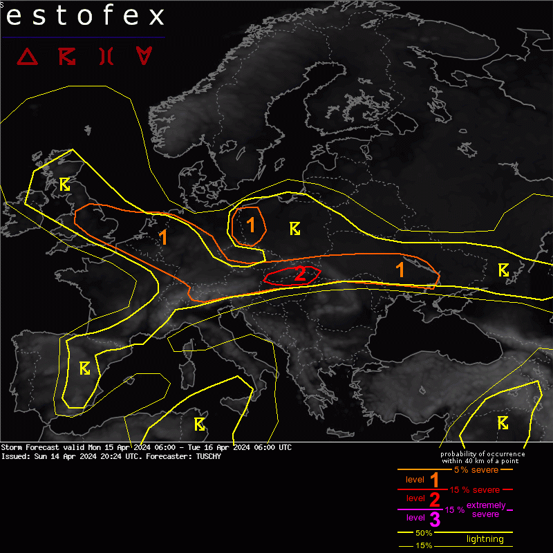
A level 1 was issued across SE UK into CNTRL Germany mainly for severe wind gusts and an isolated hail/tornado risk.
...Benelux into Germany ...
A very dynamic cold front passage is forecast during the daytime hours, which affects Benelux during the early afternoon and Germany thereafter.
Dynamics and kinematics are impressive with some weak prefrontal MUCAPE forecast especially from Benlux into W-CNTRL Germany. With forecast 0-3 km wind field, strong to severe wind gusts will be the main hazard with this frontal passage.
Regarding a QLCS tornado risk some signals arise from Belgium, Luxembourg into W-CNTRL Germany. There, 50 to 60 kt 0-3km shear vectors turn a bit more favorable regarding line orientation with strongest postfrontal pressure rise and placed just beneath the exit of an intense upper jet. However, prefrontal MUCAPE remains on the low-end side with drier prefrontal BL airmass and marginal moisture surge ahead of the front. An isolated embedded tornado event along forward racing surges is forecast - same for an isolated hail event with strongest storms.
Postfrontal convection flares up beneath cooling mid-levels with numerous thunderstorms forecast mainly from the Netherlands into far W/NW Germany. Uncapped and weakly unstable, those storms also have a chance to rotate with improving hodograph structures. Hail, strong to severe wind gusts and an isolated tornado are all possible. However, weakening diabatic heating works against this risk.
2x dagelijks weerbericht | Waarschuwingen bij extreem weer | Facebook/X/Instagram: MeteoWard