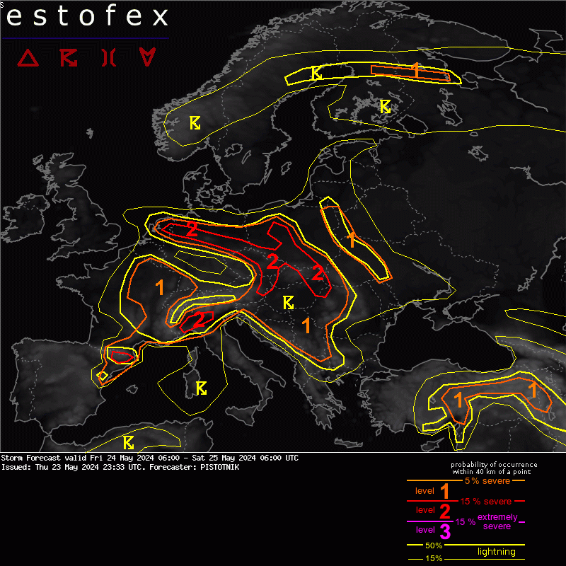
En daarbij gaat het dus om de onweersbuien die aan de voorzijde van het lagedrukgebiedje gaan ontstaan.
A level 1 and level 2 are issued for the Netherlands, central to E Germany mainly for excessive convective rainfall and to a lesser degree for tornadoes.
DISCUSSION
... central Europe between central France, BeNeLux, Germany, Poland, the Baltic States, Romania and the Alps ...
Despite rather poor lapse rates, the rich low-level moisture is "recycled" into low to moderate CAPE (up to 1000 J/kg, locally more along convergence zones and/or delayed vertical mixing) and allows another round of scattered to widespread, daytime-driven thunderstorms. Under mostly weak vertical wind shear, single cells, multicells and loosely organized clusters are the expected convective modes, and excessive rain is clearly the main hazard. The highest storm coverage is expected at the forward flank of a small cyclone over central Germany, where faint warm air advection and positive vorticity advection create synoptic lift that overlaps with moderate CAPE from Hungary into the Netherlands. This belt is therefore covered by a level 2. In contrast, clouds and rain as well as low-level stabilization quench thunderstorm activity at the cyclone's rear flank across the SW half of Germany.