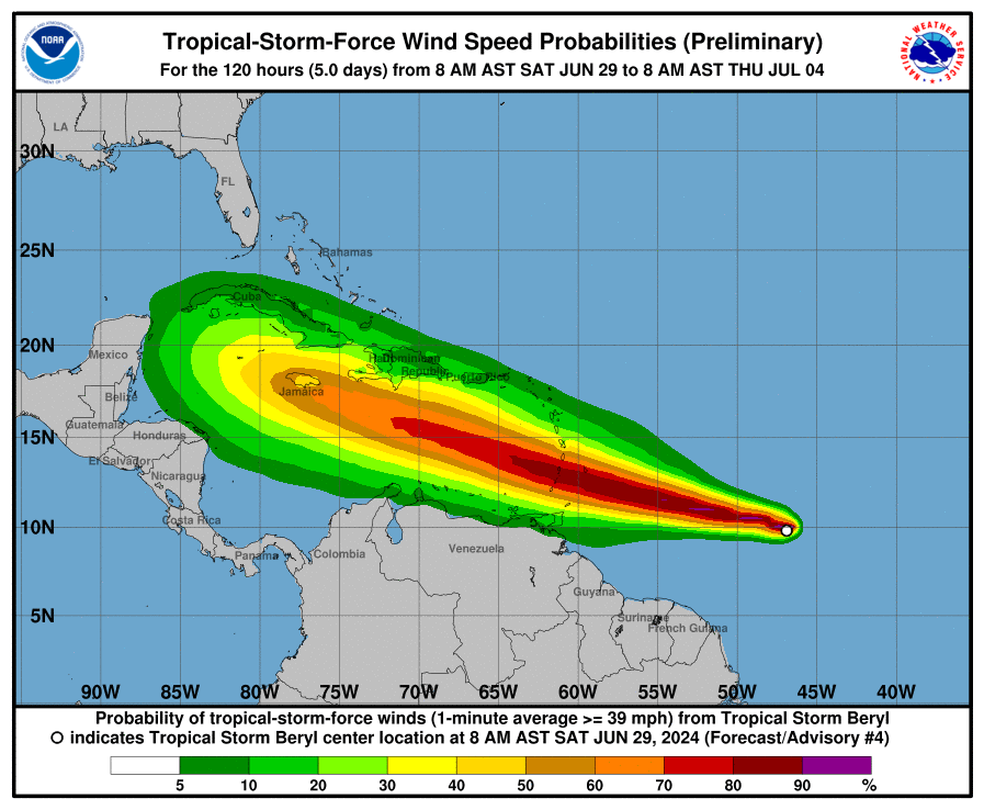
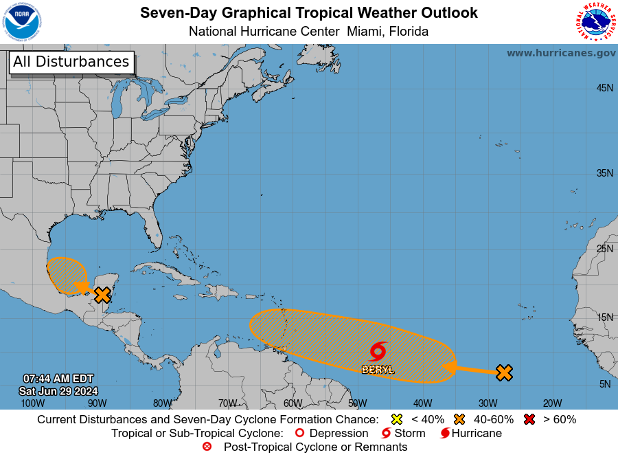
Barbados en Leeward Islands liggen in de vuurlinie. Nu nog tropische storm maar zal snel hurricane status krijgen. Zowiezo aardig actieve periode nu want volgende systeem ligt alweer klaar op centrale Atlantische oceaan.
Tropical Storm Beryl is centered near 9.8N 45.5W at 29/0900 UTC
or 850 nm ESE of Barbados, moving W at 18 kt. Estimated minimum
central pressure is 1001 mb. Maximum sustained wind speed is 45
kt with gusts to 55 kt. Peak seas are currently 13 ft. Numerous
moderate to strong convection is noted within 120 nm in the E
semicircle and 210 nm in the W semicircle of Beryl. Additional
steady to rapid strengthening is expected during the next couple
of days, and Beryl is expected to become a hurricane tonight or
Sunday. A relatively quick westward to west-northwestward motion
is expected during the next few days. On the forecast track, the
system is expected to move across the Windward Islands late Sunday
night and Monday. Tropical Storm Beryl is expected to produce rainfall
totals of 3 to 6 inches across Barbados and the Windward Islands.
This rainfall may produce localized flooding in vulnerable areas.
Swells generated by the system are expected to reach the
Windward and southern Leeward Islands by late Sunday. These
swells are likely to cause life-threatening surf and rip current
conditions.