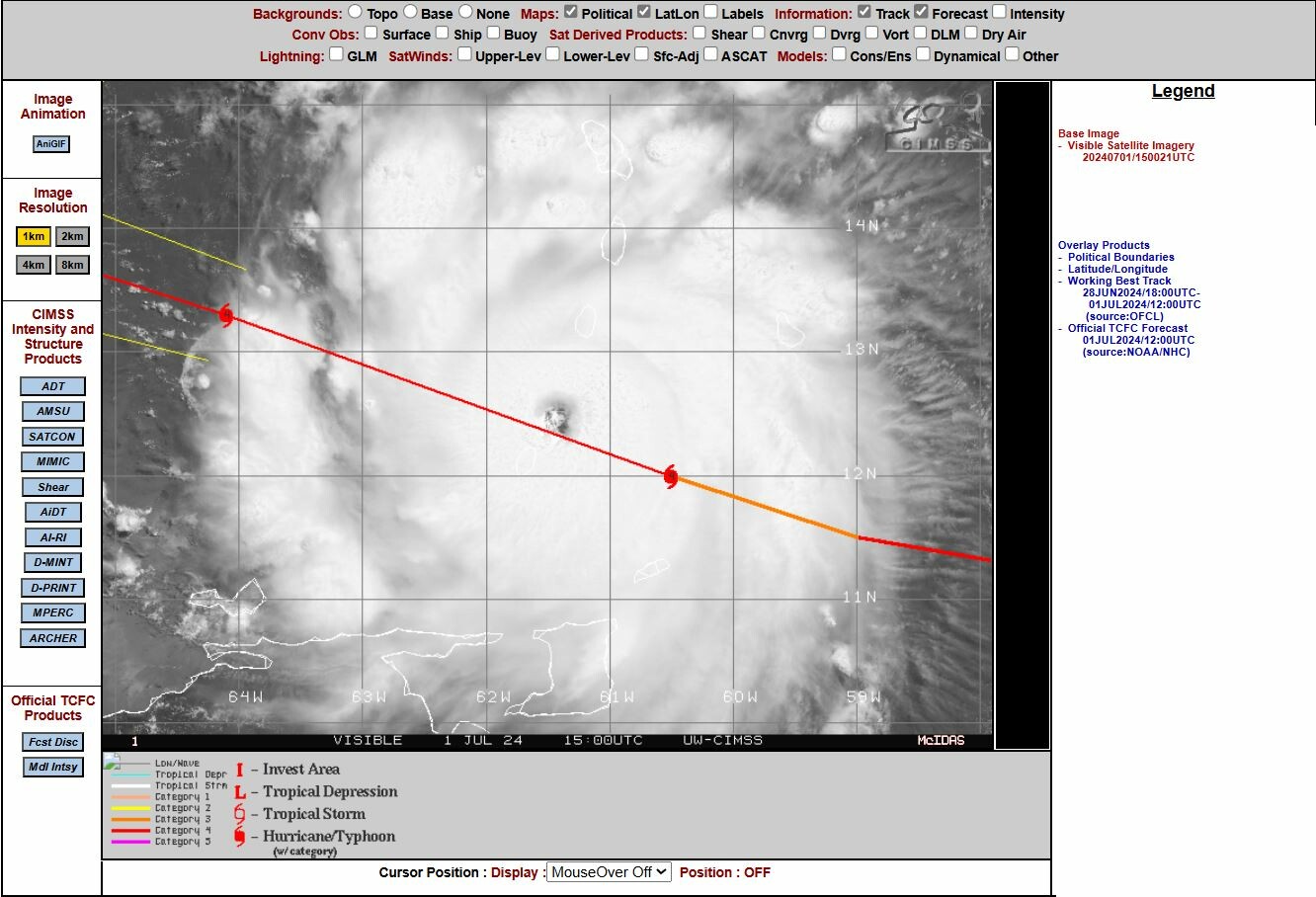
waarbij de intensiteit even tot 195 kmh zakte. Nus is hij op grotere sterkte met 240 kmh.
000
WTNT62 KNHC 011552
TCUAT2

Hurricane Beryl Tropical Cyclone Update
NWS National Hurricane Center Miami FL       AL022024
1200 PM AST Mon Jul 1 2024

...EXTREMELY DANGEROUS CATEGORY 4 BERYL PRODUCING CATASTROPHIC
WINDS AND LIFE-THREATENING STORM SURGE IN THE SOUTHERN WINDWARD
ISLANDS...

Beryl continues to produce catastrophic winds and life-threatening
storm surge to the Grenadine Islands, Carriacou Island, and Grenada.
This is an extremely dangerous and life-threatening situation.
Residents should not leave their shelter and remain in place through
the passage of these life-threatening conditions.

A weather station in St. Lucia recently reported a sustained wind
of 58 mph (93 km/h).

Another position update will be provided at 100 PM AST (1700 UTC).

SUMMARY OF 1200 PM AST...1600 UTC...INFORMATION
-----------------------------------------------
LOCATION...12.5N 61.7W
ABOUT 15 MI...20 KM W OF CARRIACOU ISLAND
ABOUT 30 MI...45 KM N OF GRENADA
MAXIMUM SUSTAINED WINDS...150 MPH...240 KM/H
PRESENT MOVEMENT...WNW OR 285 DEGREES AT 20 MPH...31 KM/H
MINIMUM CENTRAL PRESSURE...950 MB...28.05 INCHES

$$
Forecaster Kelly/Cangialosi
Bericht laatst bijgewerkt: 01-07-2024 18:17