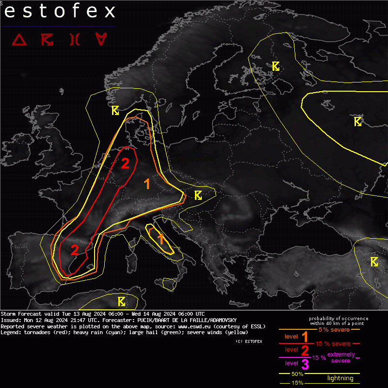
Storm Forecast
Valid: Tue 13 Aug 2024 06:00 to Wed 14 Aug 2024 06:00 UTC
Issued: Mon 12 Aug 2024 21:47
Forecaster: PUCIK/BAART DE LA FAILLE/ADAMOVSKY
A level 2 was issued across France, E BENELUX, NW Germany for large hail, severe wind gusts and heavy rainfall.
... Benelux/W-Germany ...
Very high CAPE is forecast, locally reaching 4000 J/kg. Shear will stay rather weak, allowing mostly for pulse storms or multicell clusters. Lack of clear forcing makes the forecast of initiation, coverage and the timing of the storms very difficult. There are also large differences among the models. Surface convergence seems quite random over this areas. It is possible that the outflow boundaries will play a determining role in the initiation. The first round of storms can be expected from late morning till afternoon hours. High res models suggest the highest coverage over W Germany. In the evening, further storms will spread here from France with outflow boundaries providing lift. Increase in the coverage in the evening and night may be due to the increase in the WAA. Overnight storms will likely be elevated. Afternoon storms will bring especially large hail and severe wind gusts with local flooding, whereas overnight storms may bring especially heavy rainfall.
Either in the later afternoon or early evening some SB convection will initiate with mainly a threat of large hail, possibly locally wind gusts or flash flooding, and/or convection from France will propagate over Belgium in the late evening and overnight (likely elevated) with main threat for large hail and local flash flooding.