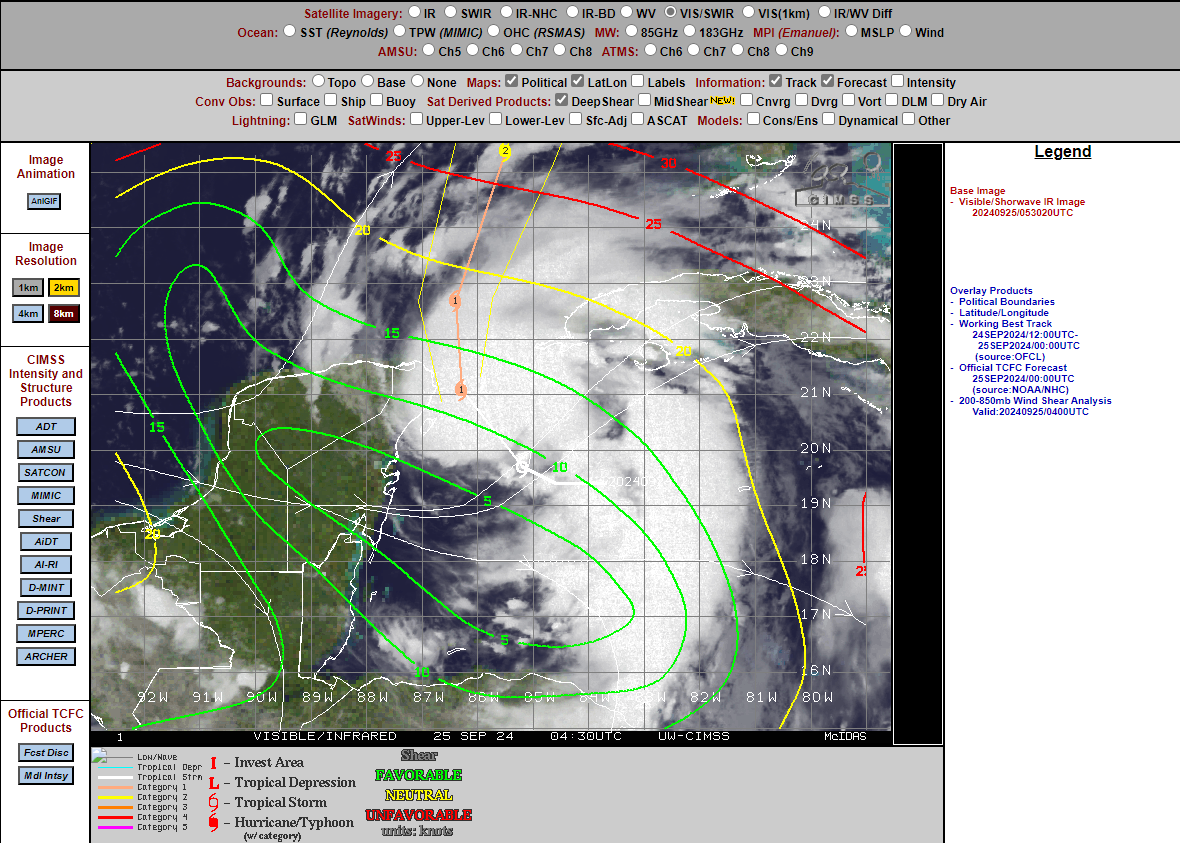
structuur nu al flink verbeterd met meer convectie in de kern en..
Bericht van: Eric, Rotterdam , 25-09-2024 08:18veel minder shear. Vandaag sterkte hij naar verwachting aan tot orkaansterkte
DISCUSSION AND OUTLOOK
----------------------
At 100 AM CDT (0600 UTC), the center of Tropical Storm Helene was
located near latitude 20.4 North, longitude 85.9 West.  Helene is
moving toward the northwest near 10 mph (17 km/h).  This motion
should continue through this morning, followed by a general
northward motion beginning later today and continuing through
Friday.  On the forecast track, the center of Helene will pass near
the northeastern coast of the Yucatan Peninsula this morning, move
across the eastern Gulf of Mexico on later today and Thursday, and
reach the Big Bend coast of Florida late Thursday.

Maximum sustained winds are near 60 mph (95 km/h) with higher gusts.
Strengthening is forecast, and Helene is expected to become a
hurricane later today.  The storm is forecast to rapidly strengthen
over the eastern Gulf of Mexico and become a major hurricane on
Thursday.

Tropical-storm-force winds extend outward up to 175 miles (280 km)
from the center.  Wind gusts of 35 to 40 mph (55 to 65 km/h) are
being reported from the northeastern Yucatan Peninsula near Cancun
and Cozumel.

The estimated minimum central pressure is 991 mb (29.27 inches).