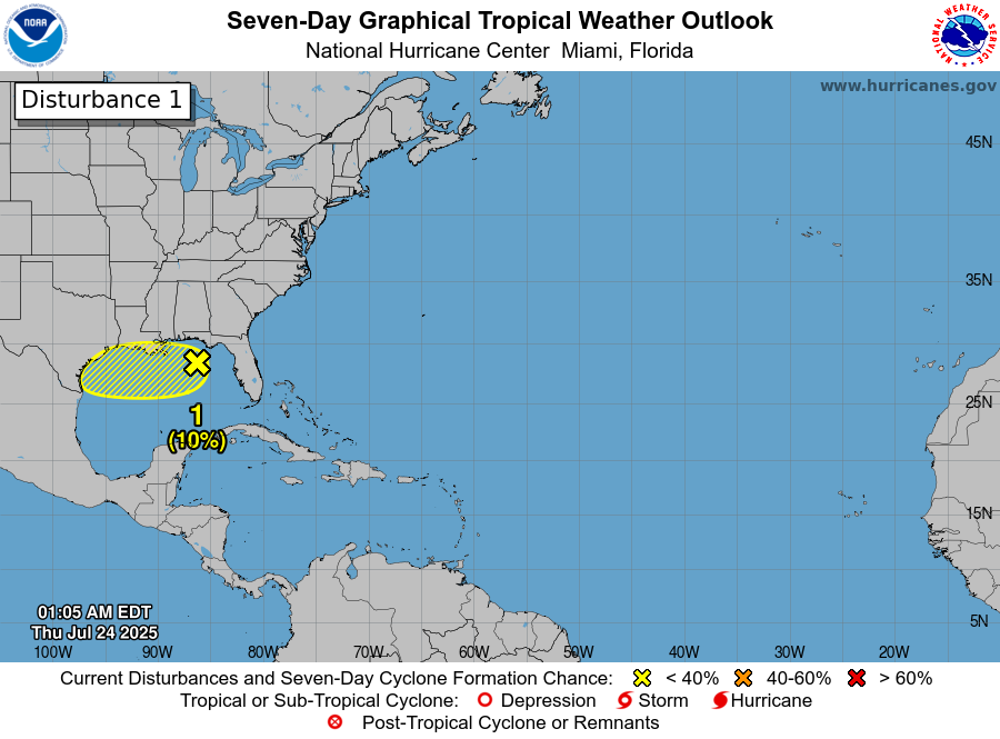
Golf van Mexico om precies te zijn. Hopelijk is er wat geleerd van de vreselijke ramp paar weken geleden met al die flash floods. Mogelijk identieke situatie op komst. Dus lokaal heel veel regen mogelijk, zeker in de heuvels en bergen.
ZCZC MIATWOAT ALL
TTAA00 KNHC DDHHMM

Tropical Weather Outlook
NWS National Hurricane Center Miami FL
200 AM EDT Thu Jul 24 2025

For the North Atlantic...Caribbean Sea and the Gulf of America:

1. North-Central and Northeastern Gulf:
A trough of low pressure over the northeastern Gulf is currently
producing a broad area of disorganized showers and thunderstorms.
Over the next day or two, this system is forecast to move generally
westward across the north-central and northeastern portion of the
Gulf where some slow development is possible.  By this weekend, the
system is likely to move inland, ending its chances for development.
Regardless of tropical cyclone formation, locally heavy rainfall is
possible for portions of the northern Gulf coast through this
weekend.
* Formation chance through 48 hours...low...10 percent.
* Formation chance through 7 days...low...10 percent.