Tijdelijke koppeling tussen troposfeer en stratosfeer verwacht
Bericht van: Stefan (Wezep) , 30-12-2025 22:01Deze post is even geleend van de buren van het Netweather forum en is denk ik te interessant om niet te delen hier op Weerwoord. Het zou kunnen verklaren waarom we een tijdelijke opleving van de oceaan zien en kans op (tijdelijk) zachter weer.
Met4Cast schrijft op het Netweather forum het volgende:
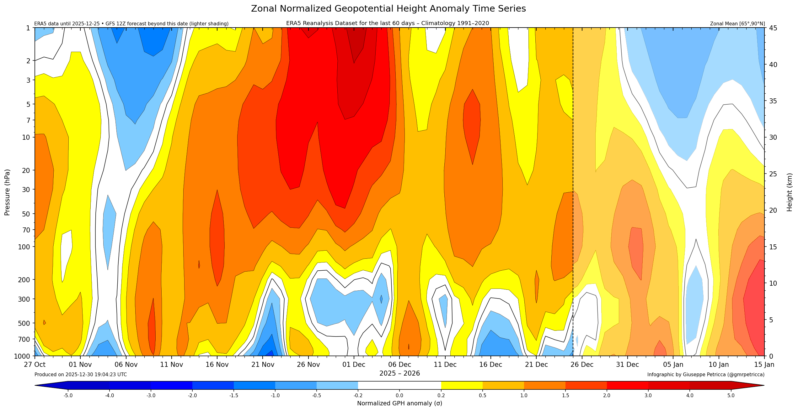
It does seem that we're going to have a brief coupling between the stratosphere and troposphere, you pretty much couldn't hand pick a more inconvenient time for this to happen. It coincides perfectly with the anticipated breakdown.
At the moment that coupling looks to be temporary with a stronger de-coupling quickly following thereafter. The EPS are more favourable than the GEFS on the 12z suite still and there's still a lot to be resolved on how this breakdown unfolds.
I don't see any reason that we wont see a return to blocking post-coupling event assuming it is as temporary as currently modelled, mid month perhaps the next "period of interest" for re-amplification. What's noteworthy is that there is very little signal for a strong tropospheric vortex or strong zonal Atlantic jet stream, brief coupling aside the lower strat remains rather weak and disorganised.
Kort samengevat (als ik het goed begrijp en vertaal) komt het er op neer dat er (helaas op een ongunstig tijdstip) tijdelijk een koppeling is tussen de troposfeer en de stratosfeer (het blauwe stukje tussen 6 en 8 januari) dat vanaf grondniveau (zie Y-as links) naar 1hPa niveau omhoog gaat met een wit stukje er tussen. Je ziet verder dat vanaf 9/10 januari de koppeling tussen de troposfeer en stratosfeer weer verbroken wordt (boven blauw, onder rood) wat wederom tot een blokkade zou kunnen leiden met eventuele kou uitstroom.